MyTopo
Hampshire Illinois US Topo Map
Couldn't load pickup availability
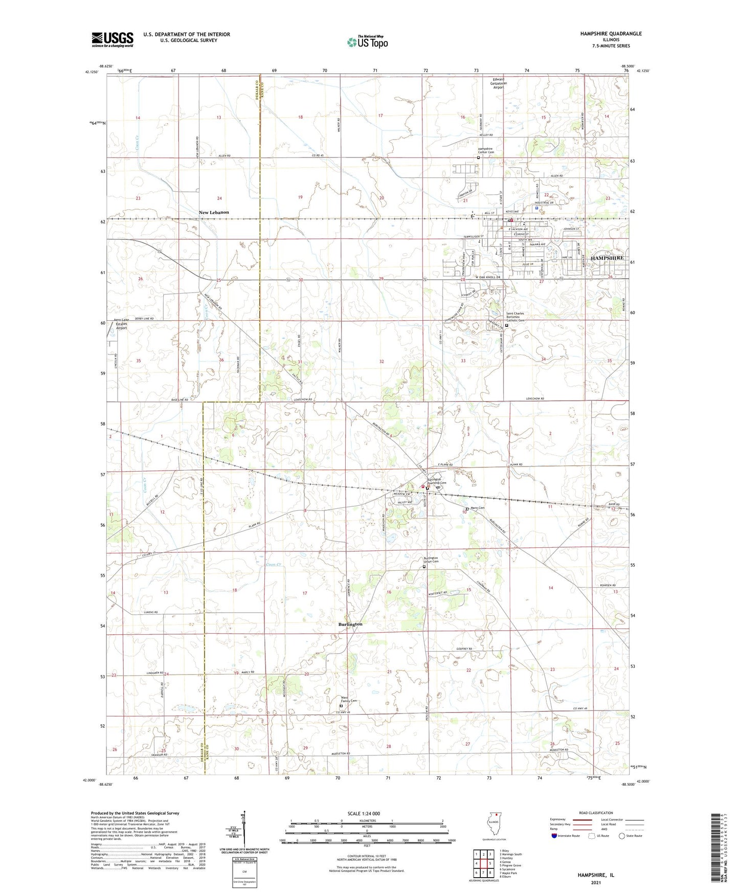
2024 topographic map quadrangle Hampshire in the state of Illinois. Scale: 1:24000. Based on the newly updated USGS 7.5' US Topo map series, this map is in the following counties: Kane, DeKalb. The map contains contour data, water features, and other items you are used to seeing on USGS maps, but also has updated roads and other features. This is the next generation of topographic maps. Printed on high-quality waterproof paper with UV fade-resistant inks.
Quads adjacent to this one:
West: Genoa
Northwest: Riley
North: Marengo South
Northeast: Huntley
East: Pingree Grove
Southeast: Elburn
South: Maple Park
Southwest: Sycamore
This map covers the same area as the classic USGS quad with code o42088a5.
Contains the following named places: Bell School, Brush School, Burlington, Burlington Community Fire Protection District, Burlington Elementary School, Burlington Post Office, Burlington Prairie Nature Preserve, Burlington Union Cemetery, Coon Creek Sod Farms, First United Methodist Church, Hampshire, Hampshire Center Cemetery, Hampshire Elementary School, Hampshire Fire Protection District, Hampshire High School, Hampshire Middle School, Hampshire Park, Hampshire Police Department, Hampshire Post Office, Mann Cemetery, Nelson School, New Lebanon, Peplow School, Plank Road Apple Orchard, Reiser School, Saint Charles Borromeo Catholic Cemetery, Saint Charles Borromeo Roman Catholic Church, Saint Charles Borromeo School, Schultz School, Township of Burlington, Township of Hampshire, Trinity Lutheran Church, Village Bible Church, Village of Burlington, Village of Hampshire, Walker School, Ward Family Cemetery, Young School, Zion United Methodist Church, ZIP Codes: 60109, 60140