MyTopo
Marengo South Illinois US Topo Map
Couldn't load pickup availability
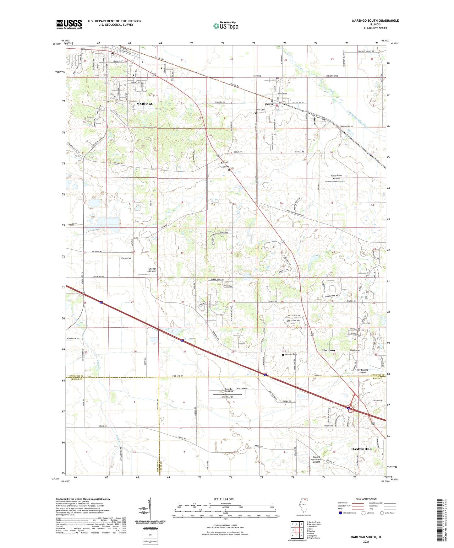
2024 topographic map quadrangle Marengo South in the state of Illinois. Scale: 1:24000. Based on the newly updated USGS 7.5' US Topo map series, this map is in the following counties: McHenry, Kane, DeKalb. The map contains contour data, water features, and other items you are used to seeing on USGS maps, but also has updated roads and other features. This is the next generation of topographic maps. Printed on high-quality waterproof paper with UV fade-resistant inks.
Quads adjacent to this one:
West: Riley
Northwest: Garden Prairie
North: Marengo North
Northeast: Woodstock
East: Huntley
Southeast: Pingree Grove
South: Hampshire
Southwest: Genoa
This map covers the same area as the classic USGS quad with code o42088b5.
Contains the following named places: Aldens Farms, Anthony School, Bean School, Browntown, Casa De Aero Park, Coniston Farms, Coral, Coral Cemetery, Coral Census Designated Place, Dr Joseph W Esser Airport, Edward Getzelman Airport, Emerick Airport, Far Field, Ferris Field, First Baptist Church, First Presbyterian Church, Fox Valley Nursery, Funny Farm Airport, Harmony, Harmony Cemetery, Harmony Census Designated Place, Heath School, Illinois Railway Museum, Locust Elementary School, MacGovern School, Marengo, Marengo City Hall, Marengo High School, Marengo Post Office, Marengo Public Library, Marengo United Methodist Church, Ney School, Oak Grove School, Reid School, Sewald School, Sky Soaring Airport, Township of Coral, Union, Union Cemetery, Union Fire Protection District, Union Post Office, Union Village Police Department, Village of Union, West Harmony School, ZIP Code: 60180