MyTopo
Riley Illinois US Topo Map
Couldn't load pickup availability
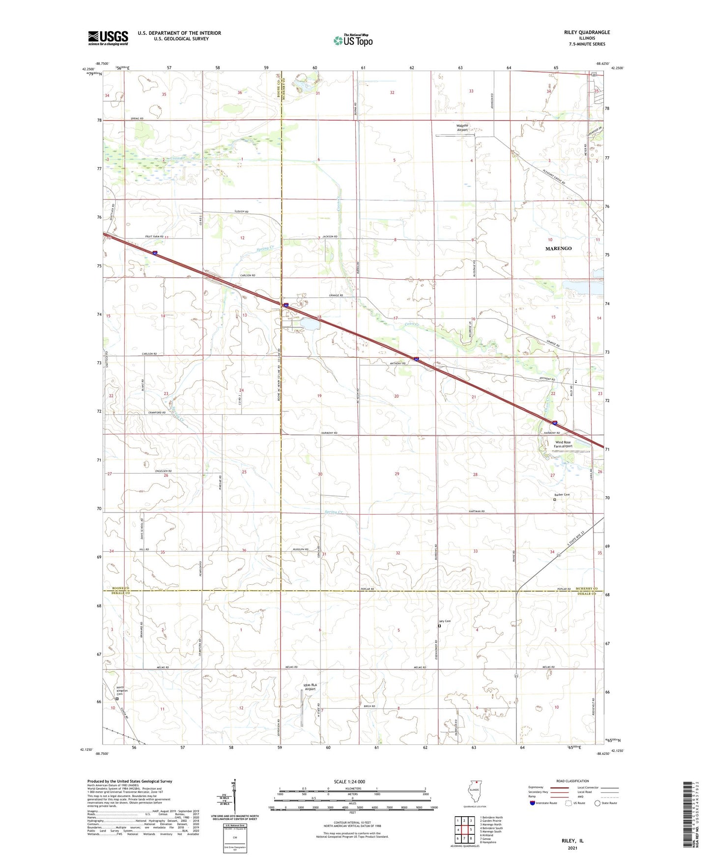
2024 topographic map quadrangle Riley in the state of Illinois. Scale: 1:24000. Based on the newly updated USGS 7.5' US Topo map series, this map is in the following counties: McHenry, Boone, DeKalb. The map contains contour data, water features, and other items you are used to seeing on USGS maps, but also has updated roads and other features. This is the next generation of topographic maps. Printed on high-quality waterproof paper with UV fade-resistant inks.
Quads adjacent to this one:
West: Belvidere South
Northwest: Belvidere North
North: Garden Prairie
Northeast: Marengo North
East: Marengo South
Southeast: Hampshire
South: Genoa
Southwest: Kirkland
This map covers the same area as the classic USGS quad with code o42088b6.
Contains the following named places: Barber Cemetery, Burke Farm, Burrows Farms, City of Marengo, Curtis School, Driver School, Fay School, Hickory Grove School, Holly Hock Farms, Idlas RLA Airport, Indian Trails, Java School, Krause Airport, Ney Cemetery, Ney Church, North Kingston Cemetery, North Pit, Number 10 School, Ramme Airport, Reed School, Riley, Riley Census Designated Place, Riley Community Consolidated School, Rinegar School, South Riley Post Office, South Riley School, Spring Creek, Township of Riley, Walpole Airport, Williamson School, Wind Rose Farm Airport, ZIP Code: 60152