MyTopo
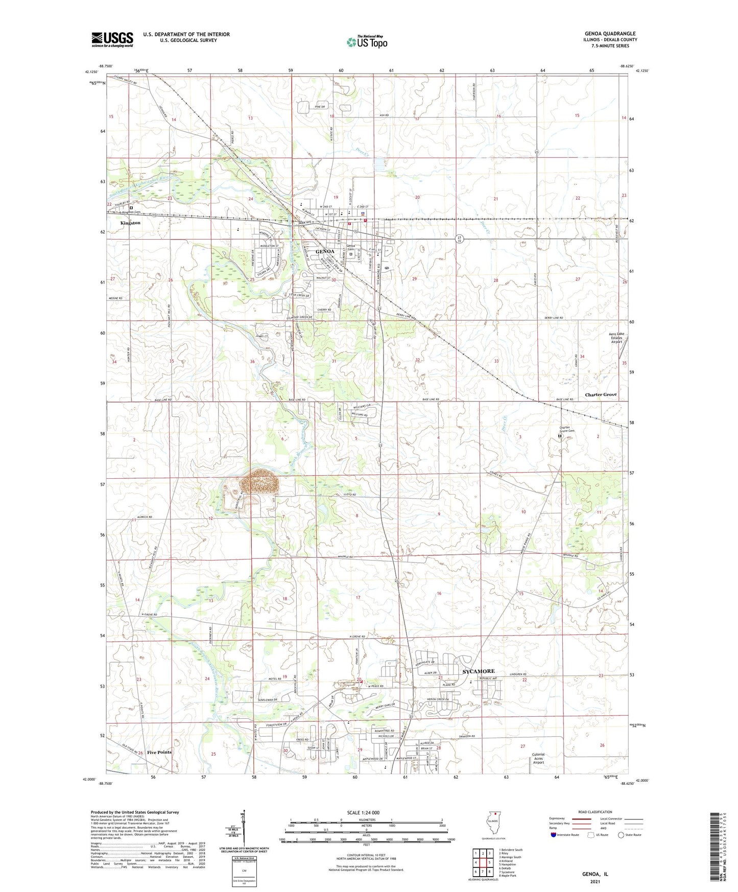
Genoa Illinois US Topo Map
Couldn't load pickup availability
2024 topographic map quadrangle Genoa in the state of Illinois. Scale: 1:24000. Based on the newly updated USGS 7.5' US Topo map series, this map is in the following counties: DeKalb. The map contains contour data, water features, and other items you are used to seeing on USGS maps, but also has updated roads and other features. This is the next generation of topographic maps. Printed on high-quality waterproof paper with UV fade-resistant inks.
Quads adjacent to this one:
West: Kirkland
Northwest: Belvidere South
North: Riley
Northeast: Marengo South
East: Hampshire
Southeast: Maple Park
South: Sycamore
Southwest: DeKalb
This map covers the same area as the classic USGS quad with code o42088a6.
Contains the following named places: Aero Lake Estates Airport, Anderson Airport, Base Line School, Charter Grove, Charter Grove Cemetery, Charter Grove School, City of Genoa, Davenport Elementary School, Deer Creek, Derby Line School, East Branch South Branch Kishwaukee River, Faith Tabernacle Church, Faith United Methodist Church, First Baptist Church of Genoa, Five Points, Foursquare Gospel Church, Genoa, Genoa - Kingston Ambulance, Genoa - Kingston Fire Protection District Station 1, Genoa - Kingston Fire Protection District Station 2, Genoa Cemetery, Genoa Center School, Genoa Middle School, Genoa Police Department, Genoa Post Office, Genoa-Kingston High School, Henrietta, J Walter Becker Memorial Park, Kingston Cemetery, Moose Range Park, North Elementary School, North Grove School, Oak Glen School, Olmstead School, Parke School, Person School, Pleasant Hill School, Richard C Watson Airport, Russell Forest Preserve, Saint Catherine Church, Sycamore Junior High School, Township of Genoa, Township of Sycamore, Wetzel Park, Willis Airport, WSQR-AM (Sycamore), ZIP Codes: 60135, 60178