MyTopo
Oak Hill Illinois US Topo Map
Couldn't load pickup availability
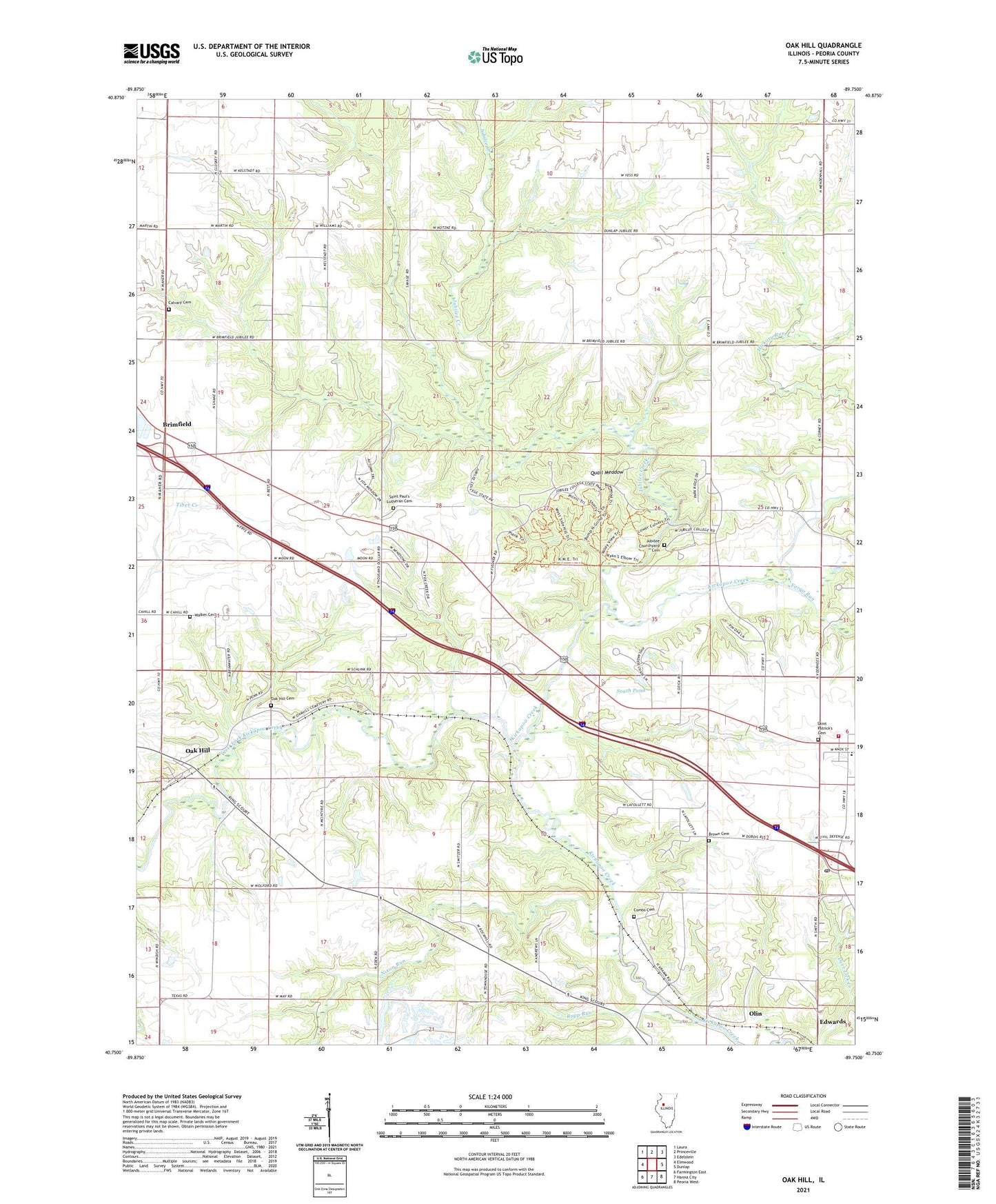
2024 topographic map quadrangle Oak Hill in the state of Illinois. Scale: 1:24000. Based on the newly updated USGS 7.5' US Topo map series, this map is in the following counties: Peoria. The map contains contour data, water features, and other items you are used to seeing on USGS maps, but also has updated roads and other features. This is the next generation of topographic maps. Printed on high-quality waterproof paper with UV fade-resistant inks.
Quads adjacent to this one:
West: Elmwood
Northwest: Laura
North: Princeville
Northeast: Edelstein
East: Dunlap
Southeast: Peoria West
South: Hanna City
Southwest: Farmington East
This map covers the same area as the classic USGS quad with code o40089g7.
Contains the following named places: Bow Wood Glen Picnic Area, Bramble School, Brimfield Community Fire Protection District Station 2, Brown Cemetery, Brown School, Cahill School, Calvary Cemetery, Center School, Combs Cemetery, Edwards Post Office, Fargo Run, Golden Knoll School, Gray Horse Farm, Greenbush School, Jubilee Churchyard Cemetery, Jubilee College, Jubilee College Forest Nature Preserve, Jubilee College State Park, Jubilee Creek, Jubilee Lodge Home for Girls, Jubilee Town Hall, Kickapoo, Kramm, Moore School, Nixon Run, Nixon School, Oak Hill, Oak Hill Cemetery, Olin, Peoria County, Prairie Lane Picnic Area, Quail Meadow, Red Fox Run Picnic Area, Rupp Run, Saint Marys School, Saint Patrick's Cemetery, Saint Paul's Lutheran Cemetery, Shane School, South Pond, South Pond Dam, Township of Jubilee, Township of Rosefield, Turkey Hollow Picnic Area, Valley View Picnic Area, Walker Cemetery, West Fork Kickapoo Creek, ZIP Code: 61517