MyTopo
Heathsville Illinois US Topo Map
Couldn't load pickup availability
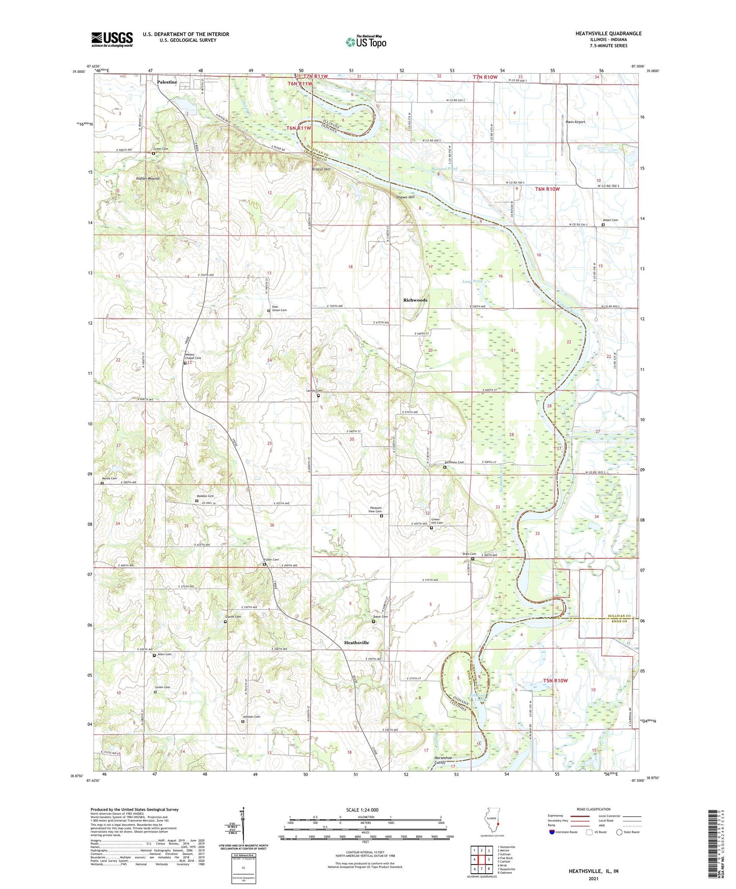
2024 topographic map quadrangle Heathsville in the states of Illinois, Indiana. Scale: 1:24000. Based on the newly updated USGS 7.5' US Topo map series, this map is in the following counties: Crawford, Sullivan, Knox. The map contains contour data, water features, and other items you are used to seeing on USGS maps, but also has updated roads and other features. This is the next generation of topographic maps. Printed on high-quality waterproof paper with UV fade-resistant inks.
Quads adjacent to this one:
West: Flat Rock
Northwest: Hutsonville
North: Merom
Northeast: Sullivan
East: Carlisle
Southeast: Oaktown
South: Russellville
Southwest: Birds
Contains the following named places: Adams School, Allen Cemetery, Bailey Farm, Baker Cemetery, Bartmess Cemetery, Bennett Cemetery, Brightlight Ferry, Bristol Hill, Buzzard Pond, Cannon School, Centennial School, East Union Cemetery, Fuller Cemetery, Ganies Cemetery, Gill Township Levee, Gordon Goat Farm, Grace Church, Grays Pond, Green Cemetery, Green Hill Cemetery, Green Hill Church, Heathsville, Hite Ferry, Horseshoe Cutoff, Indian Mound, Johnson Cemetery, Johnsons Cutoff, Lackey Cemetery, Lamotte Creek, Leaverton Park, Long Pond, Longtown Ferry, Maddox Cemetery, Mann Airport, McKiven School, Milam Cemetery, Minnow Slough, Morea Cemetery, No Business Creek, Pleasant View Cemetery, Pleasant View Church, Richwoods, Ryan Farms, Shaw Cemetery, Shawn Hill, Shaws Landing, Stoner Farms, Sugar Creek, Sweet Creek, Township of Montgomery, Washington Elementary and Junior High School, Wesley Chapel Cemetery, Wheeler School, ZIP Code: 62451