MyTopo
Sullivan Indiana US Topo Map
Couldn't load pickup availability
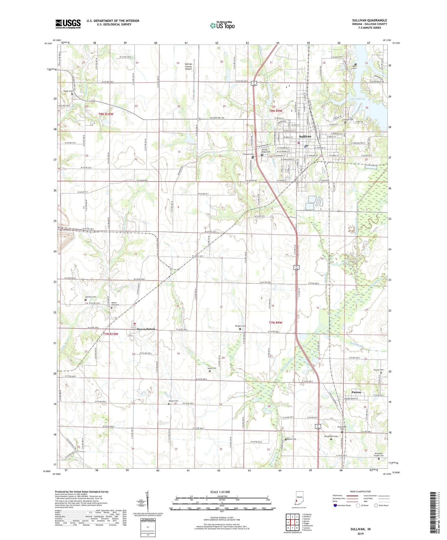
2022 topographic map quadrangle Sullivan in the state of Indiana. Scale: 1:24000. Based on the newly updated USGS 7.5' US Topo map series, this map is in the following counties: Sullivan. The map contains contour data, water features, and other items you are used to seeing on USGS maps, but also has updated roads and other features. This is the next generation of topographic maps. Printed on high-quality waterproof paper with UV fade-resistant inks.
Quads adjacent to this one:
West: Merom
Northwest: Fairbanks
North: Shelburn
Northeast: Hymera
East: Dugger
Southeast: Bucktown
South: Carlisle
Southwest: Heathsville
This map covers the same area as the classic USGS quad with code o39087a4.
Contains the following named places: Bible View Church, Boone Cemetery, Buck Creek, Burnett Cemetery, Busseron Dam Number L-1, Busseron Dam Number L-S, Buttermilk Creek, Center Ridge Cemetery, Central Elementary School, City of Sullivan, Coffman Cemetery, Evangelic Church, Gill Township Volunteer Fire Department Station 2, Lake Sullivan, McCammon Cemetery, McClellan Snyder Cemetery, Morgan Cemetery, Mount Tabor Church, Mount Zion Cemetery, New Lebanon, Parson Cemetery, Paxton, Poplar Cemetery, Providence Cemetery, Purcell Cemetery, Robbins Branch, Rose Chapel, South Cemetery, Sullivan, Sullivan City Fire Department Station 1, Sullivan City Fire Department Station 2, Sullivan County, Sullivan County Airport, Sullivan County Ambulance Service, Sullivan County Park, Sullivan County Sheriff's Office, Sullivan High School, Sullivan Junior High School, Sullivan Police Department, Sullivan Post Office, Timmons Cemetery, Township of Hamilton, Walls Cemetery, WNDI-AM (Sullivan), WNDI-FM (Sullivan), ZIP Codes: 47865, 47882