MyTopo
Vera Illinois US Topo Map
Couldn't load pickup availability
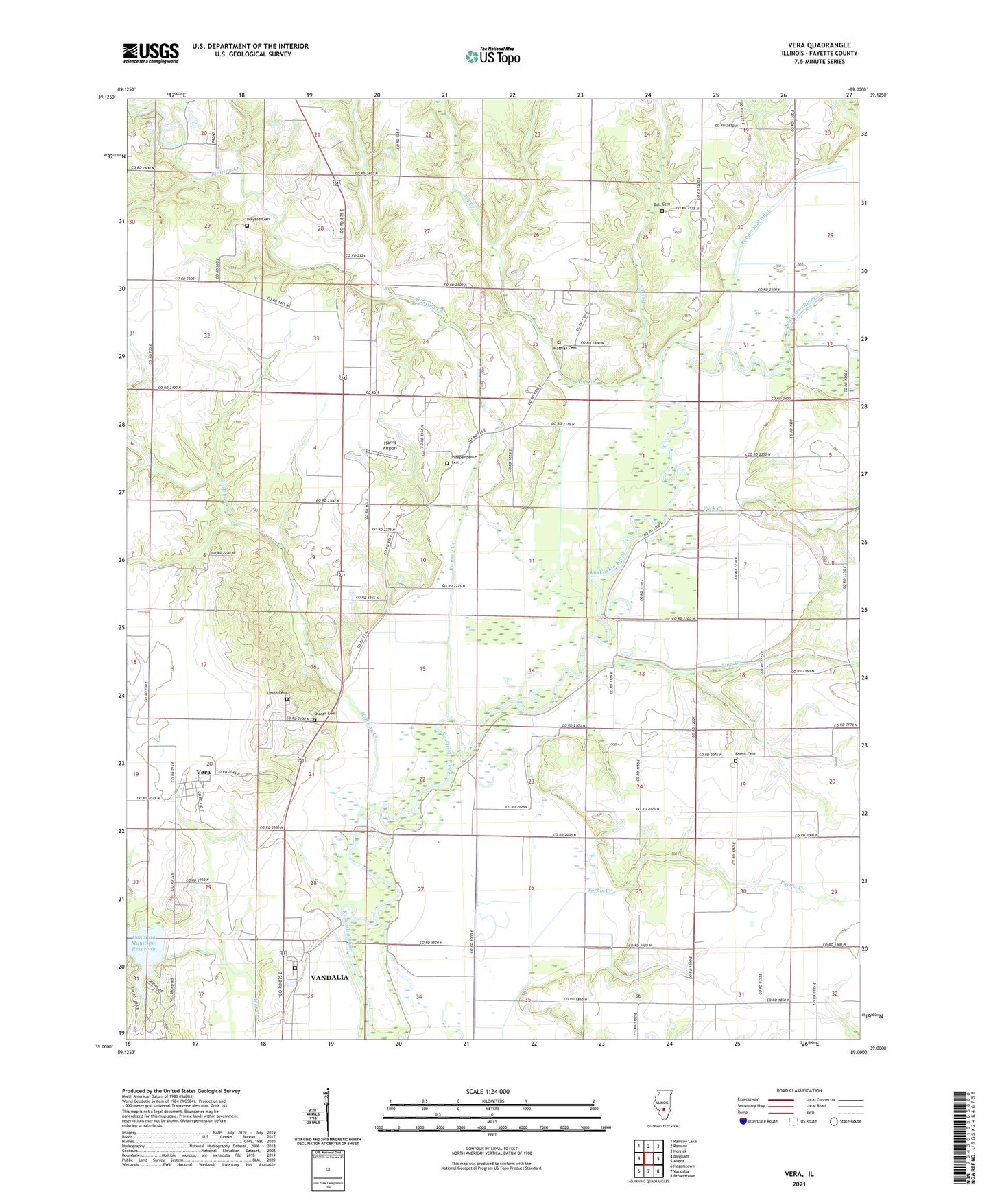
2024 topographic map quadrangle Vera in the state of Illinois. Scale: 1:24000. Based on the newly updated USGS 7.5' US Topo map series, this map is in the following counties: Fayette. The map contains contour data, water features, and other items you are used to seeing on USGS maps, but also has updated roads and other features. This is the next generation of topographic maps. Printed on high-quality waterproof paper with UV fade-resistant inks.
Quads adjacent to this one:
West: Bingham
Northwest: Ramsey Lake
North: Ramsey
Northeast: Herrick
East: Avena
Southeast: Brownstown
South: Vandalia
Southwest: Hagarstown
This map covers the same area as the classic USGS quad with code o39089a1.
Contains the following named places: Ash Creek, Behoboth Camp, Bethany Church, Big Four School, Bolt Cemetery, Bolt Creek, Bolyard Cemetery, Brick School, Emanuel Church, Fayette County, Forbis Cemetery, Forbis Creek, Harris Airport, Hillside School, Hoffman Creek, Independence Cemetery, Independence Church, Independence School, Linn Creek, Mathias Cemetery, McKinney School, Monclovia School, Oak Grove School, Oakdale School, Okaw School, Peppermill Ditch, Ramsey Creek, Sanders Hill School, Sharon Cemetery, Suck Creek, Township of Sharon, Union Cemetery, Union School, Vandalia Correctional Center, Vandalia Municipal Reservoir Dam, Vera, Williams School