MyTopo
Herrin Illinois US Topo Map
Couldn't load pickup availability
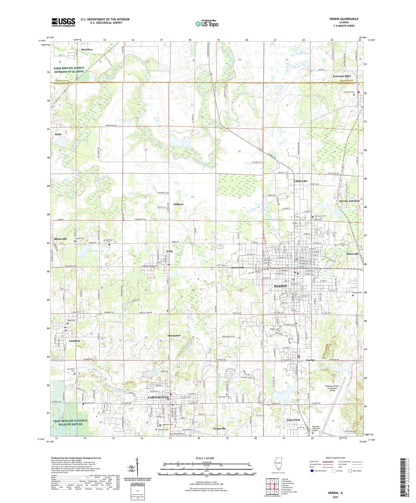
2024 topographic map quadrangle Herrin in the state of Illinois. Scale: 1:24000. Based on the newly updated USGS 7.5' US Topo map series, this map is in the following counties: Williamson, Franklin. The map contains contour data, water features, and other items you are used to seeing on USGS maps, but also has updated roads and other features. This is the next generation of topographic maps. Printed on high-quality waterproof paper with UV fade-resistant inks.
Quads adjacent to this one:
West: De Soto
Northwest: Elkville
North: Christopher
Northeast: West Frankfort
East: Johnston City
Southeast: Marion
South: Crab Orchard Lake
Southwest: Carbondale
This map covers the same area as the classic USGS quad with code o37089g1.
Contains the following named places: Adams Street Baptist Church, Blairsville, Blairsville Census Designated Place, Blairsville Election Precinct, Blue Blaze Mobile Home Estates, Brush Junction, Bryan Street Baptist Church, Buster Pond, Cambria, Cambria Elementary School, Cambria Fire Department, Cambria Neck, Cambria Police Department, Cambria Post Office, Carterville, Carterville Elementary School, Carterville Fire Department, Carterville High School, Carterville Police Department, Carterville Post Office, Carterville United Methodist Church, Carterville Waterworks, Chittyville, Chittyville Public School, Church of God, Church of the Nazarene, City of Carterville, City of Herrin, Clifford, Colp, Colp Post Office, Crab Orchard Golf Club, Crainville, Crainville Elementary School, Crainville Police Department, Cundiff Cemetery, Dewmaine, Eden Park, Egyptian Memorial Garden, Energy, Energy Elementary School, Energy Police Department, Energy Post Office, Energy United Methodist Church, Energy Volunteer Fire Department, First Apostolic Church, First Baptist Church, First Christian Church, First Pentecostal Church, First Presbyterian Church, First United Methodist Church, Fredonia, Fredonia Post Office, Freeman Cemetery, Freeman Spur Post Office, Freeman Spur Volunteer Fire Department, Grand Avenue Baptist Church, Greathouse Cemetery, Hafer Baptist Church, Herrin, Herrin Cemetery, Herrin City Hall, Herrin City Library, Herrin Fire Department, Herrin Free Methodist Church, Herrin High School, Herrin Hospital, Herrin Junction, Herrin Junior High School, Herrin Police Department, Herrin Post Office, Herrin Reservoir, Herrin Reservoir Number 1 Dam, Herrin Waterworks, Hillcrest Cemetery, Hinchcliff Cemetery, Holy Spirit Catholic Church, Hurricane Cemetery, Hurricane Creek, Hurricane Memorial Baptist Church, Illinois No Name Number 63 Dam, J D Carney Mobile Home Park, Kingdom Hall of Jehovahs Witnesses, Lake Creek, Lincoln Elementary School, Little Hurricane Creek, Madison Lake, Madison Lake Dam, Mount Olive Chapel, North Side Elementary School, Oakwood Cemetery, Our Lady of Mount Carmel Catholic church, Paineville, Pond Creek, Prairie Creek, Rodd Cemetery, Royalton Waterworks, Russell Cemetery, Saint Marys School, San Carlo Cemetery, Second Baptist Church, South Side Elementary School, Sunnyside, Sunnyside Public School, Trinity Lutheran Church, Union Gospel Mission, Union School, Village of Cambria, Village of Colp, Village of Crainville, Village of Energy, West Monroe Street Apostolic Church, West Side Elementary School, WHPI-AM (Herrin), Williamson County Ambulance Service, Williamson County Fire Protection District Station 2, ZIP Codes: 62841, 62915, 62918, 62921, 62933, 62948, 62999