MyTopo
Teutopolis Illinois US Topo Map
Couldn't load pickup availability
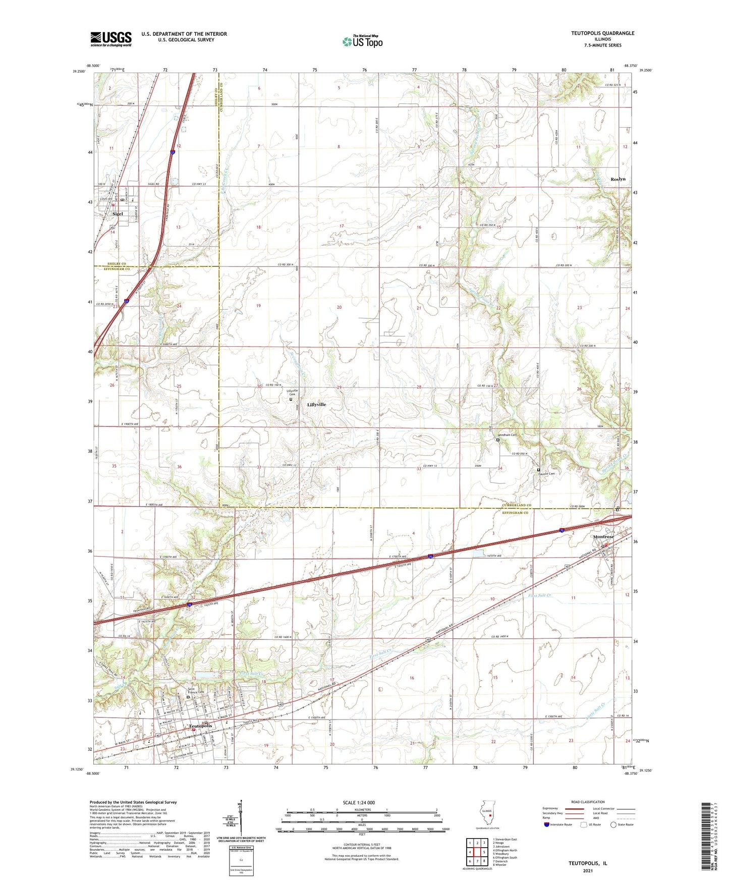
2024 topographic map quadrangle Teutopolis in the state of Illinois. Scale: 1:24000. Based on the newly updated USGS 7.5' US Topo map series, this map is in the following counties: Cumberland, Effingham, Shelby. The map contains contour data, water features, and other items you are used to seeing on USGS maps, but also has updated roads and other features. This is the next generation of topographic maps. Printed on high-quality waterproof paper with UV fade-resistant inks.
Quads adjacent to this one:
West: Effingham North
Northwest: Stewardson East
North: Neoga
Northeast: Johnstown
East: Woodbury
Southeast: Wheeler
South: Dieterich
Southwest: Effingham South
This map covers the same area as the classic USGS quad with code o39088b4.
Contains the following named places: Butterfly School, Faunce Cemetery, First Salt Creek, Lillyville, Lillyville Cemetery, Lillyville Elementary School, Looman Farms, Montrose, Montrose Cemetery, Montrose Fire Protection District, Montrose Post Office, Needham Cemetery, Niemeyer Farm, Plain Tree School, Pruemer Farms, Roslyn, Roslyn United Methodist Church, Sacred Heart Church, Saint Francis Cemetery, Saint Francis Town Hall, Saint Michael Catholic Church, Saint Michael Catholic School, Saint Rose of Lima Cemetery, Second Salt Creek, Sigel, Sigel Fire Protection District, Sigel Post Office, Spring Point School, Spring Point Town Hall, T and R Hog Farm, Teutopolis, Teutopolis Fire Protection District, Teutopolis Grade School, Teutopolis High School, Teutopolis Post Office, Teutopolis Village Hall, Town of Sigel, Township of Saint Francis, Township of Spring Point, Township of Teutopolis, Village of Montrose, Village of Teutopolis, ZIP Codes: 62462, 62467