MyTopo
Kent Illinois US Topo Map
Couldn't load pickup availability
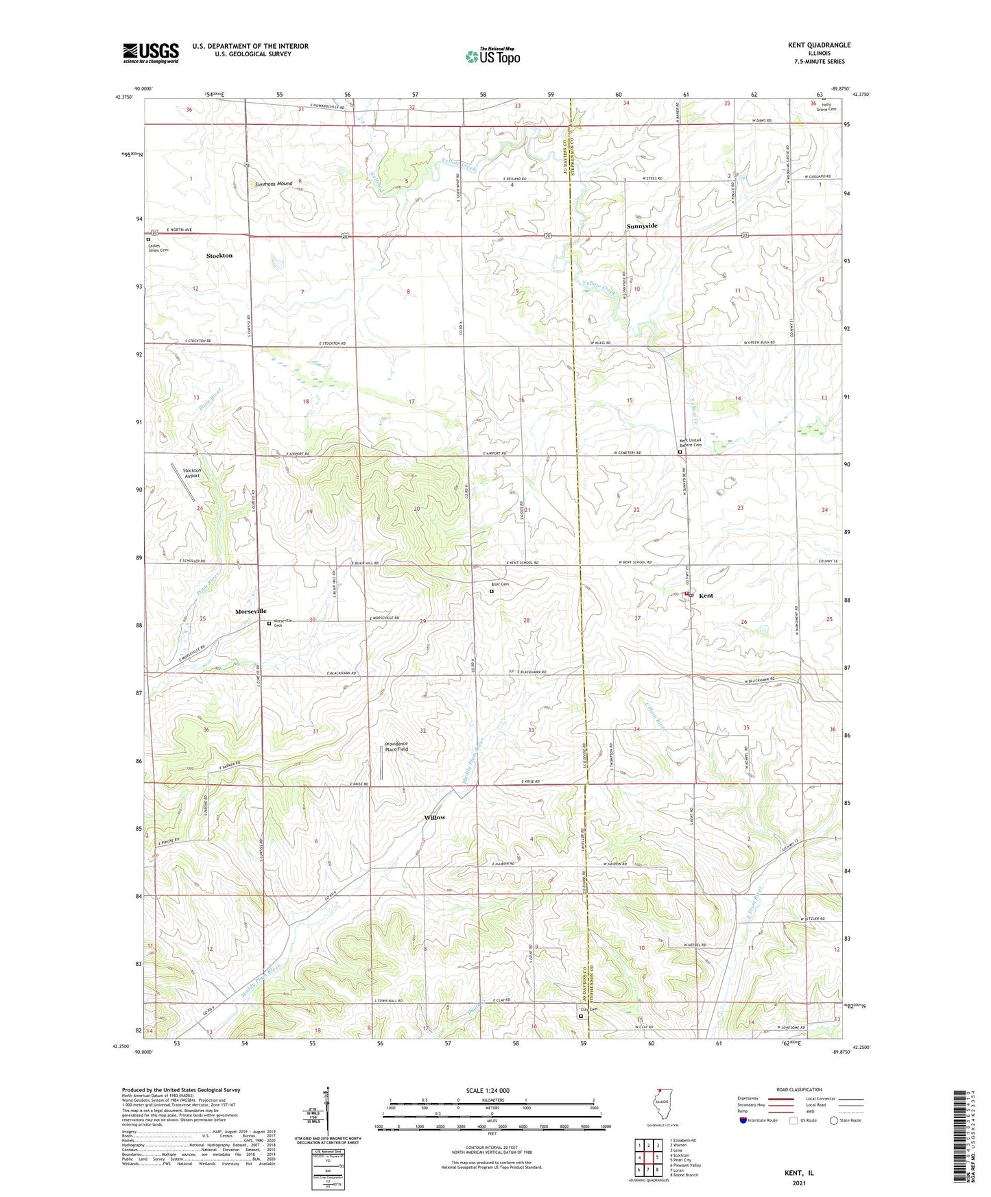
2024 topographic map quadrangle Kent in the state of Illinois. Scale: 1:24000. Based on the newly updated USGS 7.5' US Topo map series, this map is in the following counties: Jo Daviess, Stephenson. The map contains contour data, water features, and other items you are used to seeing on USGS maps, but also has updated roads and other features. This is the next generation of topographic maps. Printed on high-quality waterproof paper with UV fade-resistant inks.
Quads adjacent to this one:
West: Stockton
Northwest: Elizabeth NE
North: Warren
Northeast: Lena
East: Pearl City
Southeast: Boone Branch
South: Loran
Southwest: Pleasant Valley
This map covers the same area as the classic USGS quad with code o42089c8.
Contains the following named places: Blackhawk Battlefield Park, Blackhawk School, Blair Cemeter, Blair Cemetery, Bonnett Dairy Farms, Clay Cemetery, Clay School, East Stockton, Fitzsimmons School, Gidds School, Greenbush School, John L Coppernoll Airport, Kent, Kent Post Office, Kent United Baptist Cemetery, Morseville, Offenheiser Quarry, Pearl City Fire Department Kent Station, Pierce Quarry, Pilot Grove, Providence Place Farms, Providence Place Field, Ridge School, S and B Farms, Saint Pauls Church, Saint Pauls Lutheran Cemetery, Simmons Dairy Farm, Simmons Mound, Stockton Airport, Sunnyside, Tigerwhip School, Township of Wards Grove, Upper Kent School, Wards Grove Nature Preserve, Wards Grove School, Willow, Willow School, Willow United Methodist Church, ZIP Code: 61044