MyTopo
Pleasant Valley Illinois US Topo Map
Couldn't load pickup availability
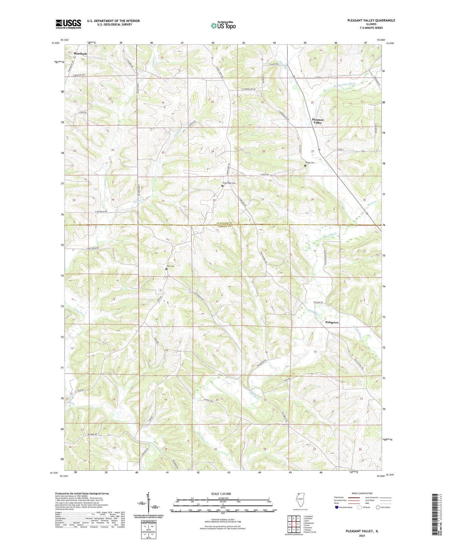
2024 topographic map quadrangle Pleasant Valley in the state of Illinois. Scale: 1:24000. Based on the newly updated USGS 7.5' US Topo map series, this map is in the following counties: Carroll, Jo Daviess. The map contains contour data, water features, and other items you are used to seeing on USGS maps, but also has updated roads and other features. This is the next generation of topographic maps. Printed on high-quality waterproof paper with UV fade-resistant inks.
Quads adjacent to this one:
West: Blackhawk
Northwest: Elizabeth
North: Stockton
Northeast: Kent
East: Loran
Southeast: Mount Carroll
South: Wacker
Southwest: Savanna
This map covers the same area as the classic USGS quad with code o42090b1.
Contains the following named places: Clifton School, Davis Creek, Deeds School, East Plum River, Five Corner Farm, Goodmiller Quarry, Haas Quarry, Little Union School, Massbach, Massbach Ridge Winery, Muddy Plum River, Oakton School, Olive School, Pleasant Valley, Polsgrove, Scrub Creek, Township of Pleasant Valley, Township of Woodland, Zion Cemetery, Zion School