MyTopo
Elizabeth NE Illinois US Topo Map
Couldn't load pickup availability
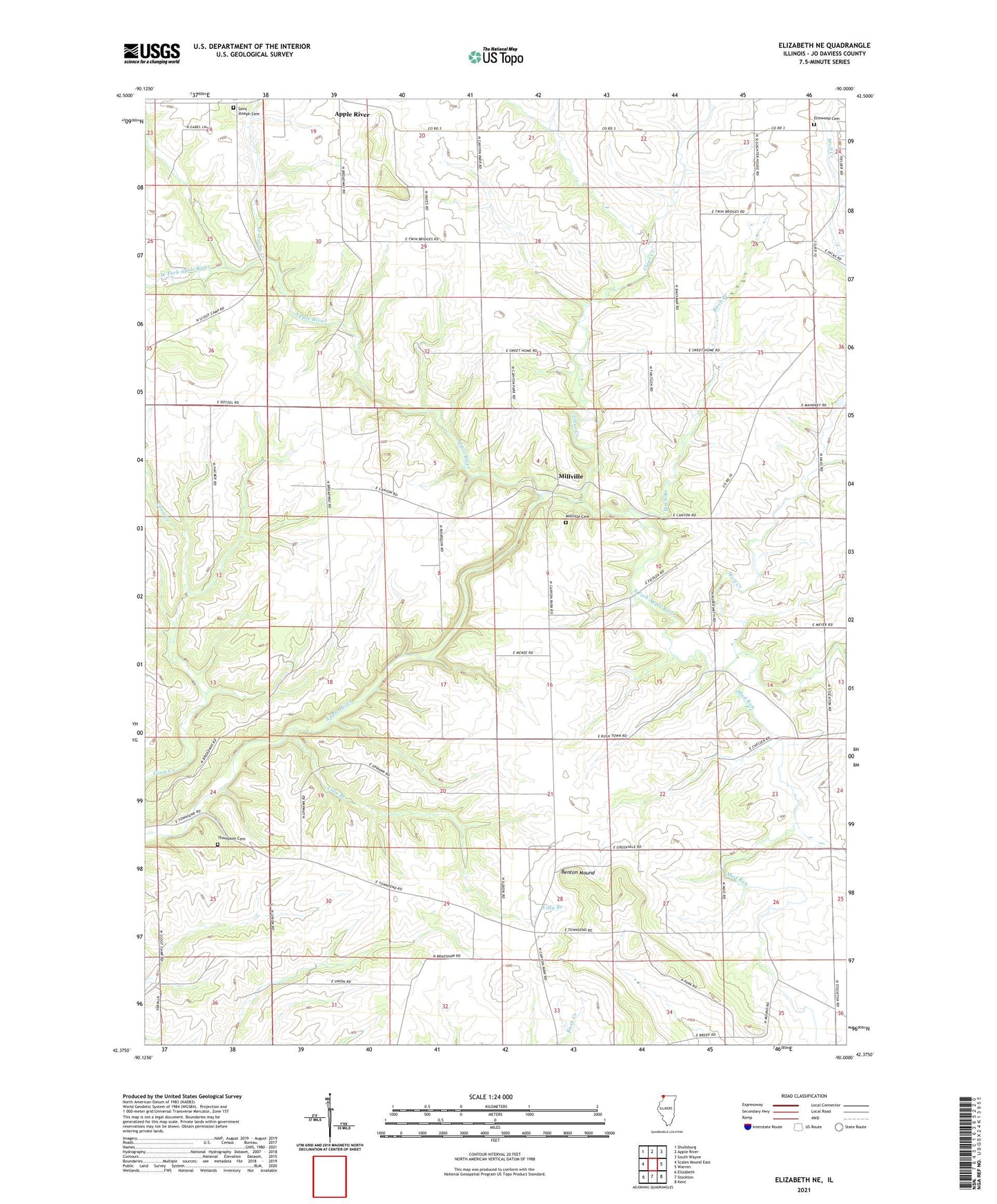
2024 topographic map quadrangle Elizabeth NE in the state of Illinois. Scale: 1:24000. Based on the newly updated USGS 7.5' US Topo map series, this map is in the following counties: Jo Daviess. The map contains contour data, water features, and other items you are used to seeing on USGS maps, but also has updated roads and other features. This is the next generation of topographic maps. Printed on high-quality waterproof paper with UV fade-resistant inks.
Quads adjacent to this one:
West: Scales Mound East
Northwest: Shullsburg
North: Apple River
Northeast: South Wayne
East: Warren
Southeast: Kent
South: Stockton
Southwest: Elizabeth
This map covers the same area as the classic USGS quad with code o42090d1.
Contains the following named places: Albion School, Apple River Canyon State Park, Benton Mound, Birch Branch, Brown School, Canyon Ridge Camping Area, Clear Creek, Devils Hollow Picnic Area, Elmwood Cemetery, Equal Rights School, Greenvale Post Office, Jefferson School, Kentucky Creek, Lilly Branch, Mead School, Millville, Millville Cemetery, Mud Run, Pepoon School, Pine Ridge Nature Trail, Primrose Nature Trail, River Route Nature Trail, Robinson School, Rockford School, Rush Center School, Saint Joseph Cemetery, South Fork Apple River, Sunset Nature Trail, Sweet Home, Sweet Home School, Thompson Cemetery, Tower Rock Nature Trail, Township of Rush, Township of Warren, Union School, Walnut Grove Youth Group Camping Area, West Fork Apple River, Wolf Creek, ZIP Code: 61001