MyTopo
Stockton Illinois US Topo Map
Couldn't load pickup availability
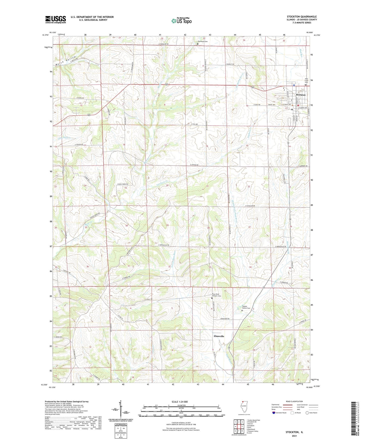
2024 topographic map quadrangle Stockton in the state of Illinois. Scale: 1:24000. Based on the newly updated USGS 7.5' US Topo map series, this map is in the following counties: Jo Daviess. The map contains contour data, water features, and other items you are used to seeing on USGS maps, but also has updated roads and other features. This is the next generation of topographic maps. Printed on high-quality waterproof paper with UV fade-resistant inks.
Quads adjacent to this one:
West: Elizabeth
Northwest: Scales Mound East
North: Elizabeth NE
Northeast: Warren
East: Kent
Southeast: Loran
South: Pleasant Valley
Southwest: Blackhawk
This map covers the same area as the classic USGS quad with code o42090c1.
Contains the following named places: Calvary United Methodist Church, Country Air Mobile Home Estates, Derinda Post Office, Elmoville, Hammond Branch, Holy Cross Cemetery, Holy Cross Church, J and J Mobile Home Park, Lawhorn Creek, Middle Fork Plum River, Millershone Quarry, Montrose School, Mount Juliet School, North Fork Plum River, Pitcherville, Plum River Catholic Cemetery, Rindesbacher Creek, Rush Post Office, Saint John Church, Spring Valley School, Stockton, Stockton Center School, Stockton Church of the Nazarene, Stockton Community Ambulance, Stockton Elementary School, Stockton Fire and Rescue, Stockton Golf Course, Stockton High School, Stockton Police Department, Stockton Post Office, Township of Stockton, Unitarian Universalist Church, Village of Stockton, Wesley United Methodist Church, West Point School, Winters Post Office, Yankee Hollow Post Office, Yankee Hollow School, ZIP Code: 61085