MyTopo
Ladd Illinois US Topo Map
Couldn't load pickup availability
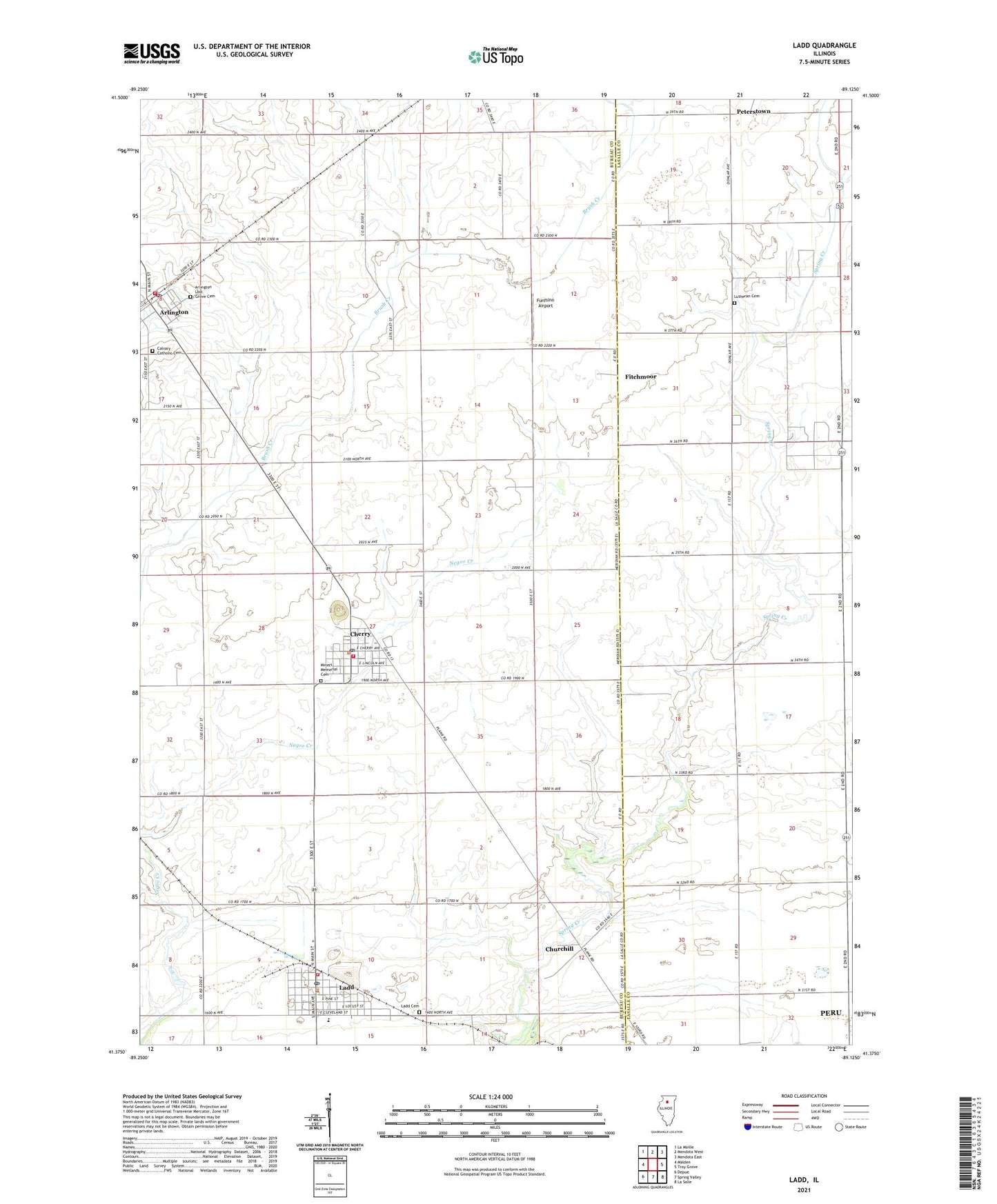
2024 topographic map quadrangle Ladd in the state of Illinois. Scale: 1:24000. Based on the newly updated USGS 7.5' US Topo map series, this map is in the following counties: Bureau, LaSalle. The map contains contour data, water features, and other items you are used to seeing on USGS maps, but also has updated roads and other features. This is the next generation of topographic maps. Printed on high-quality waterproof paper with UV fade-resistant inks.
Quads adjacent to this one:
West: Malden
Northwest: La Moille
North: Mendota West
Northeast: Mendota East
East: Troy Grove
Southeast: La Salle
South: Spring Valley
Southwest: Depue
This map covers the same area as the classic USGS quad with code o41089d2.
Contains the following named places: Arlington, Arlington Cemetery, Arlington Elementary School, Arlington Fire Protection District, Arlington Lost Grove Cemetery, Barrett School, Calvary Catholic Cemetery, Cherry, Cherry Fire Department, Cherry Grade School, Cherry Post Office, Churchill, Corley School, First Presbyterian Church of Ladd, Fitchmoor, Flaherty Field, Funfsinn Airport, Gerald H Hamer Airport, Hahn Airport, Holy Trinity Roman Catholic Church, Ladd, Ladd Cemetery, Ladd Community Consolidated School, Ladd Fire Protection District, Ladd Police Department, Ladd Post Office, Ladd Public Library, Lutheran Cemetery, Miners Memorial Cemetery, Peterstown, Pottinger RLA Airport, Saint Benedict Catholic Church, Township of Westfield, Village of Arlington, Village of Cherry, Village of Ladd, ZIP Codes: 61312, 61317, 61329