MyTopo
Troy Grove Illinois US Topo Map
Couldn't load pickup availability
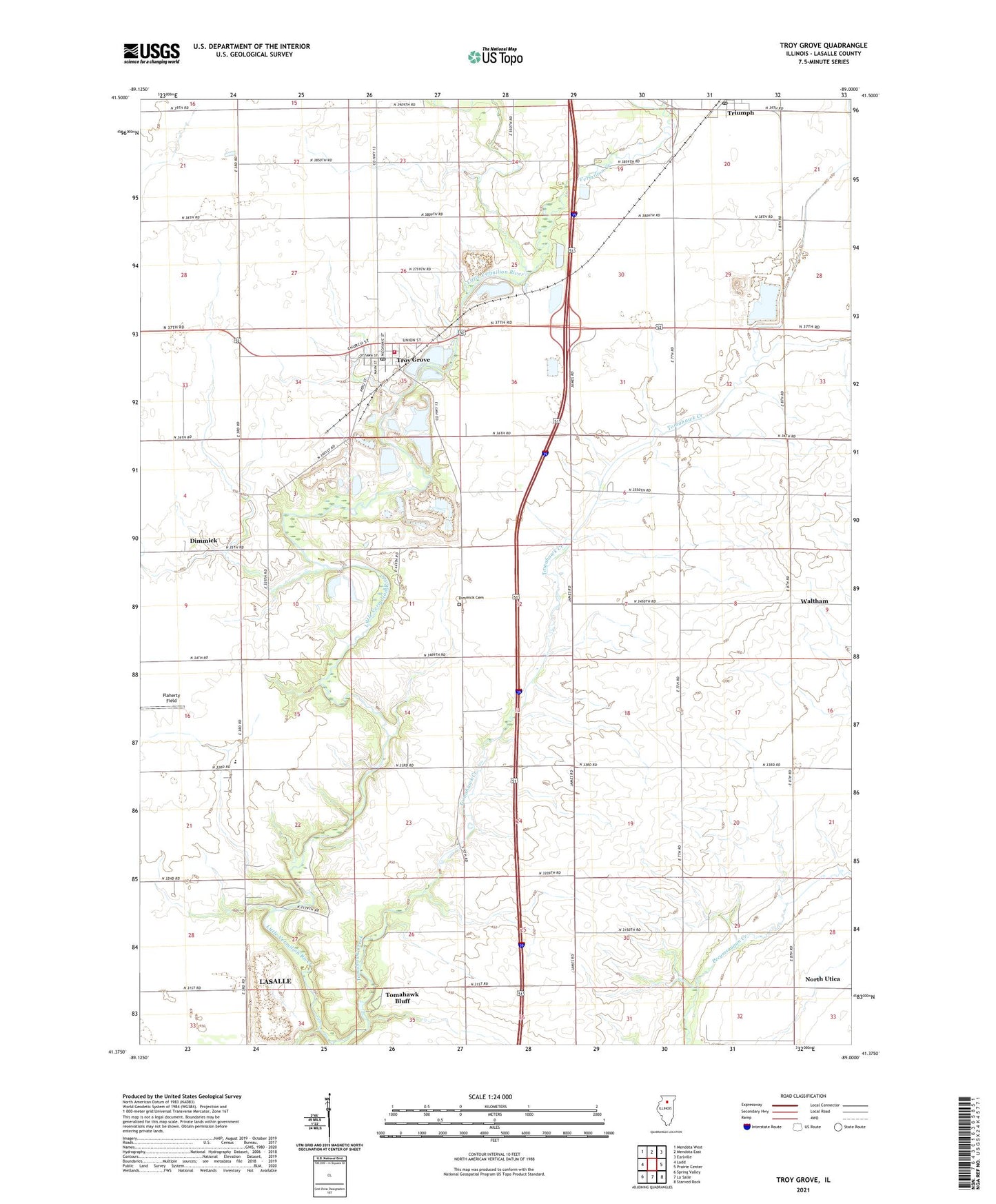
2024 topographic map quadrangle Troy Grove in the state of Illinois. Scale: 1:24000. Based on the newly updated USGS 7.5' US Topo map series, this map is in the following counties: LaSalle. The map contains contour data, water features, and other items you are used to seeing on USGS maps, but also has updated roads and other features. This is the next generation of topographic maps. Printed on high-quality waterproof paper with UV fade-resistant inks.
Quads adjacent to this one:
West: Ladd
Northwest: Mendota West
North: Mendota East
Northeast: Earlville
East: Prairie Center
Southeast: Starved Rock
South: La Salle
Southwest: Spring Valley
This map covers the same area as the classic USGS quad with code o41089d1.
Contains the following named places: Aitkin School, Brush School, Carr School, Culton, Davis Airport, Deener School, Dimmick, Dimmick Cemetery, Dimmick Community Consolidated School, Dimmick Pit, Gammel School, Mendota - Troy Grove Rural Fire Protection District, Mitchel School, Mitchells Grove Nature Preserve, Nellis School, Ophir Community Consolidated School, Tomahawk Bluff, Tomahawk Creek, Township of Dimmick, Township of Troy Grove, Triumph, Triumph Census Designated Place, Triumph Post Office, Troy Grove, Troy Grove Stone Quarry, Vermilion Creek, Village of Troy Grove, Waltham, Waltham School, Whipple School, Wylie School, ZIP Codes: 61301, 61372