MyTopo
Mendota East Illinois US Topo Map
Couldn't load pickup availability
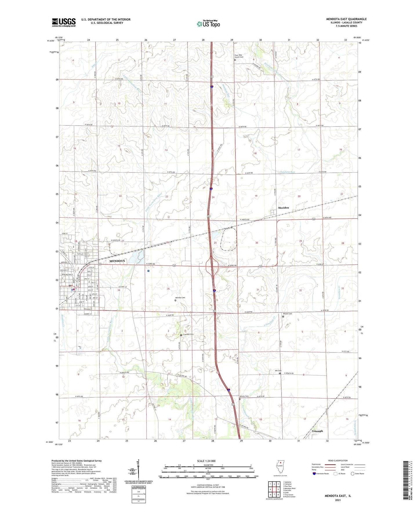
2024 topographic map quadrangle Mendota East in the state of Illinois. Scale: 1:24000. Based on the newly updated USGS 7.5' US Topo map series, this map is in the following counties: LaSalle. The map contains contour data, water features, and other items you are used to seeing on USGS maps, but also has updated roads and other features. This is the next generation of topographic maps. Printed on high-quality waterproof paper with UV fade-resistant inks.
Quads adjacent to this one:
West: Mendota West
Northwest: Sublette
North: Compton
Northeast: Paw Paw
East: Earlville
Southeast: Prairie Center
South: Troy Grove
Southwest: Ladd
This map covers the same area as the classic USGS quad with code o41089e1.
Contains the following named places: Advent Christian Church, Apple Orchard Park, Blackstone Park, City of Mendota, Crandall Cemetery, Dewey Cemetery, Doeneir Field, Faith Fellowship Church, First Baptist Church, First United Methodist Church, First United Presbyterian Church, Four Mile Grove Cemetery, Fourmile Grove Creek, Gorman School, Graves Public Library, Heritage Manor Nursing Home, Hill Cemetery, Holy Cross Catholic Church, Holy Cross School, Lincoln Elementary School, Mendota, Mendota Creek, Mendota Fire Department Station 1, Mendota Fire Department Station 2, Mendota Police Department, Mendota Post Office, Mendota Swimming Pool, Mendota Township High School, Meriden, New Life Church, Northbrook Middle School, Northbrook Missionary Baptist Church, OSF HealthCare Saint Paul Medical Center, Saint Johns Lutheran Church, Schlesinger School, Snyder Grove Park, Township of Mendota, Tri-County Fairground, WGLC-FM (Mendota), Wisner Cemetery, Worsley Cemetery, Zion United Methodist Church, ZIP Code: 61342