MyTopo
Landes Illinois US Topo Map
Couldn't load pickup availability
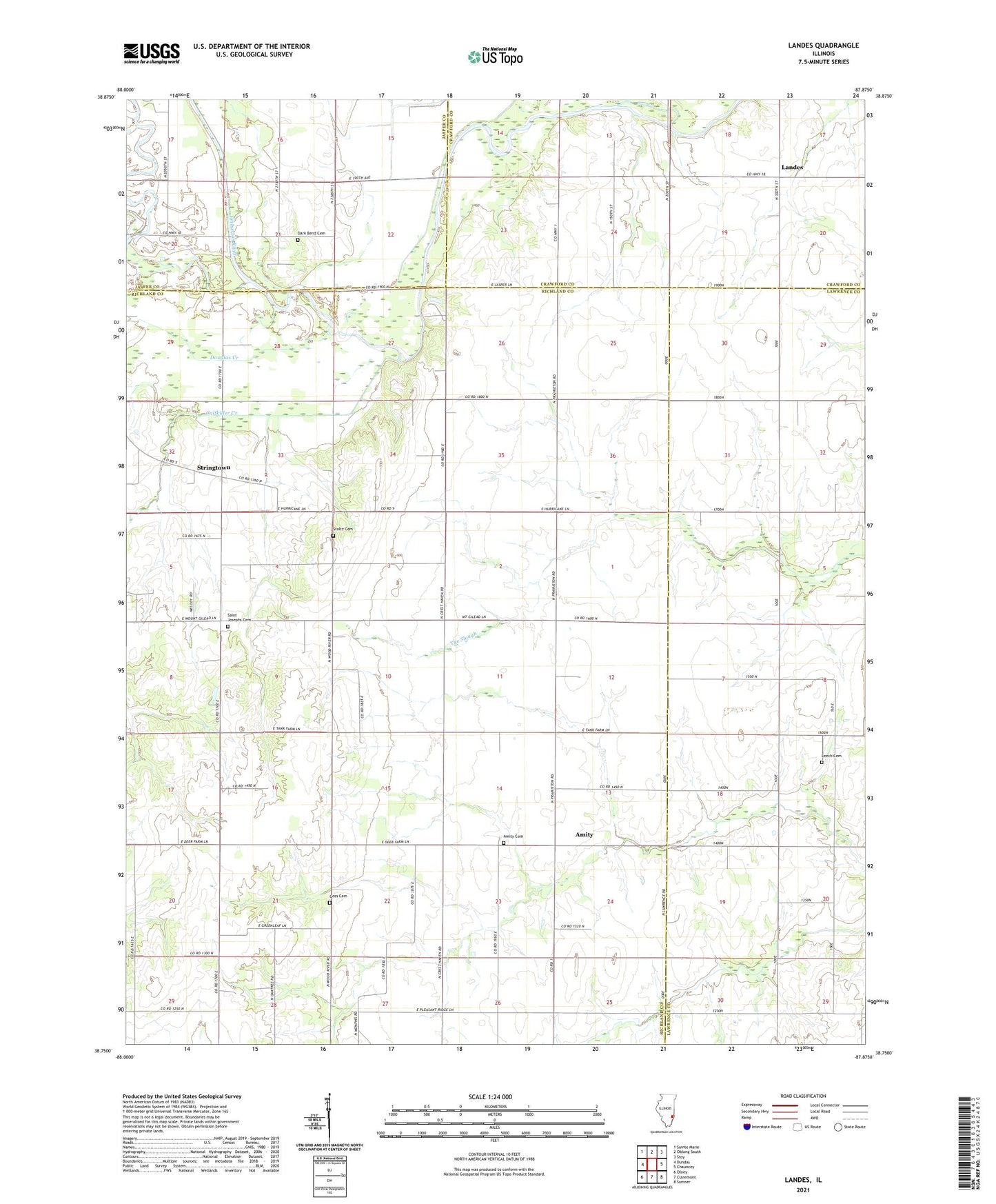
2024 topographic map quadrangle Landes in the state of Illinois. Scale: 1:24000. Based on the newly updated USGS 7.5' US Topo map series, this map is in the following counties: Richland, Lawrence, Crawford, Jasper. The map contains contour data, water features, and other items you are used to seeing on USGS maps, but also has updated roads and other features. This is the next generation of topographic maps. Printed on high-quality waterproof paper with UV fade-resistant inks.
Quads adjacent to this one:
West: Dundas
Northwest: Sainte Marie
North: Oblong South
Northeast: Stoy
East: Chauncey
Southeast: Sumner
South: Claremont
Southwest: Olney
This map covers the same area as the classic USGS quad with code o38087g8.
Contains the following named places: Amity, Amity Cemetery, Amity Chapel, Amity School, Asbury Church, Calfkiller Creek, Cotterell School, Cow Ford Ferry, Crum School, Dark Bend Cemetery, Douglas Creek, Fyffe School, Goss Cemetery, Landes, Leech Cemetery, Leech School, Mount North School, Murphy Creek, Newlight Church, Prairie Chapel, Prairie Hall Church, Prairie Hall School, Prairie School, Roney School, Saint Joseph Church, Saint Joseph School, Saint Josephs Cemetery, South Bend Church, Stoltz Cemetery, Stringtown, Township of German, Union School, ZIP Code: 62421