MyTopo
Lawrenceville Illinois US Topo Map
Couldn't load pickup availability
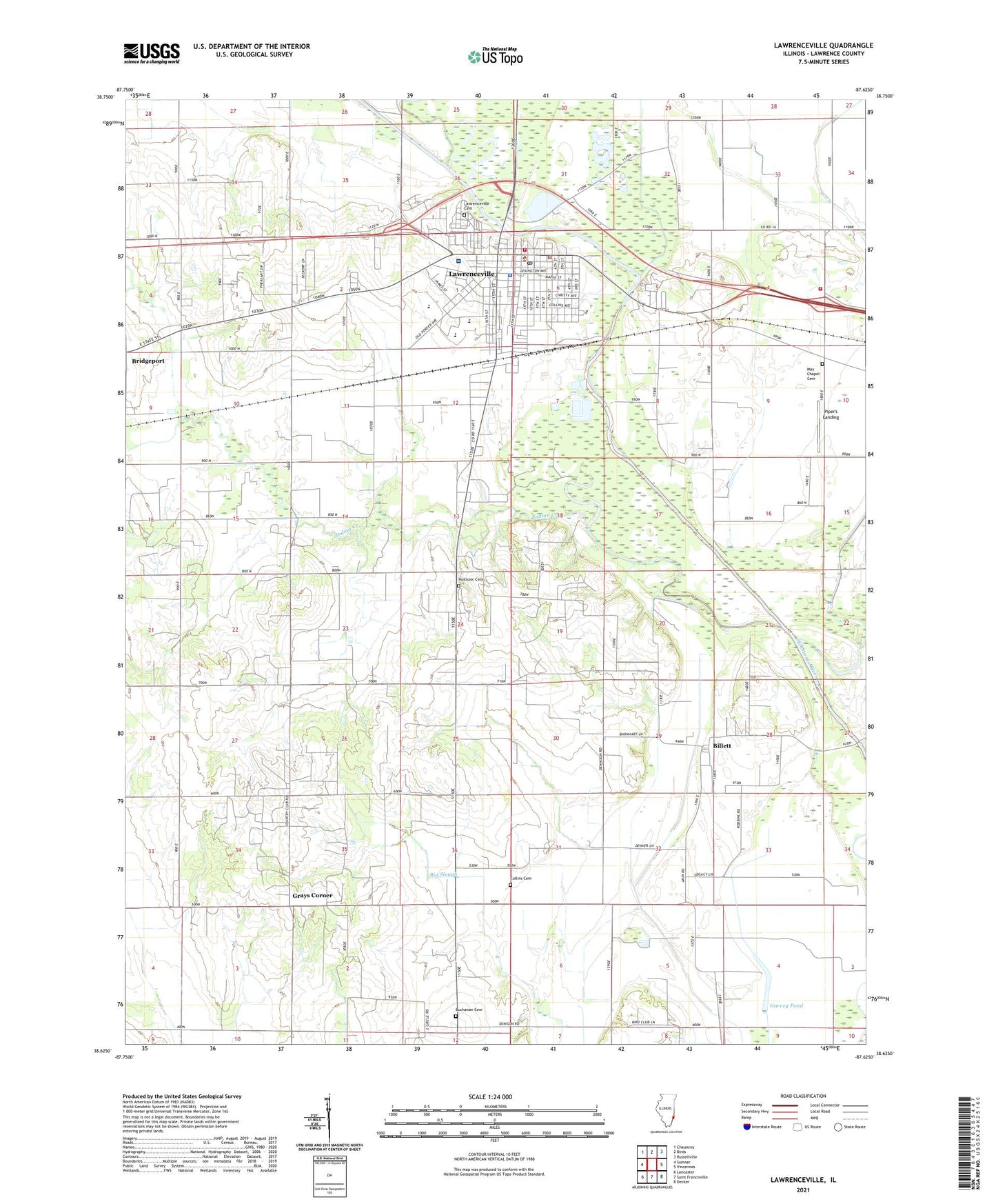
2024 topographic map quadrangle Lawrenceville in the state of Illinois. Scale: 1:24000. Based on the newly updated USGS 7.5' US Topo map series, this map is in the following counties: Lawrence. The map contains contour data, water features, and other items you are used to seeing on USGS maps, but also has updated roads and other features. This is the next generation of topographic maps. Printed on high-quality waterproof paper with UV fade-resistant inks.
Quads adjacent to this one:
West: Sumner
Northwest: Chauncey
North: Birds
Northeast: Russellville
East: Vincennes
Southeast: Decker
South: Saint Francisville
Southwest: Lancaster
This map covers the same area as the classic USGS quad with code o38087f6.
Contains the following named places: Arlington Elementary School, Billett, Billett School, Billett United Methodist Church, Buchanan Cemetery, Buchanan Church, Buchanan School, Central Elementary School, City of Lawrenceville, Collins Cemetery, Collins School, Crossroads School, Dunlap Airport, England Ditch, Faith Church of the Nazarene, Fillmore School, First Baptist Church, First Christian Church, First Church of God, First Presbyterian Church, First United Methodist Church, Free Methodist Church, Fremont School, Garvey Pond, Grays Corner, Grisold, Hi-Way Church of God, Hollister Cemetery, Indian Creek, Indian Heliport, Jackson, Lawrence - Allison Fire Protection District, Lawrence - Allison Fire Protection District Station 2, Lawrence Co Memorial Hospital Heliport, Lawrence County, Lawrence County Courthouse, Lawrence County Memorial Hospital, Lawrence County Sheriff's Office, Lawrence Public Libary, Lawrenceville, Lawrenceville Cemetery, Lawrenceville City Hall, Lawrenceville High School, Lawrenceville Post Office, Lincoln Elementary School, May Chapel, May Chapel Cemetery, Otterbein United Methodist Church, Our Savior Lutheran Church, Parkview Junior High School, Piper's Landing, Pisgah Church, Saint Lawrence Catholic Church, Saint Lawrence School, Sand Ridge School, Shoal Tract, Township of Denison, Township of Lawrence, WAKO-AM (Lawrenceville), WAKO-FM (Lawrenceville), Zion United Methodist Church, ZIP Code: 62439