MyTopo
Decker Indiana US Topo Map
Couldn't load pickup availability
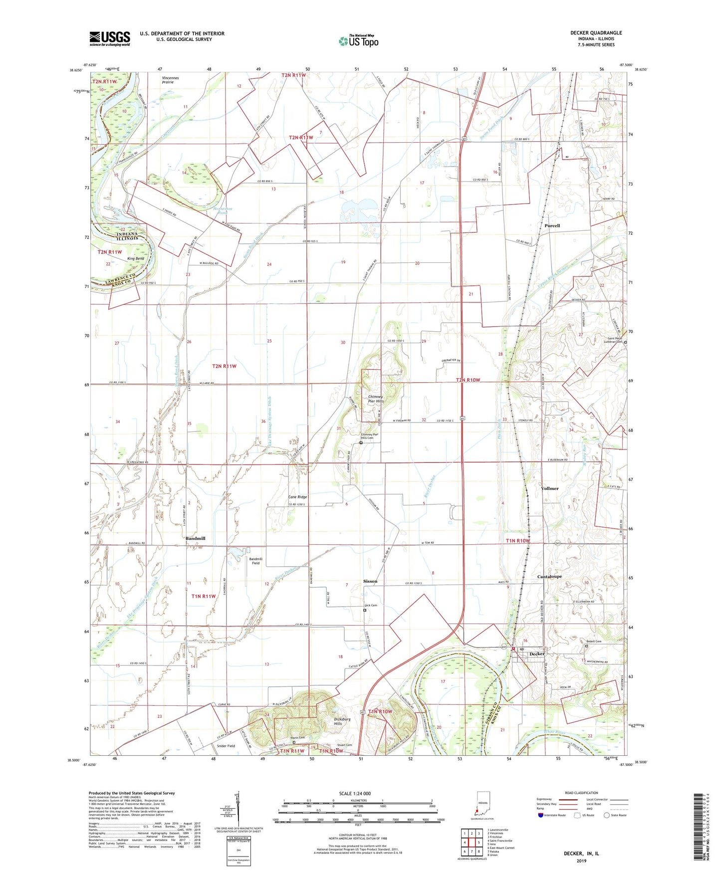
2022 topographic map quadrangle Decker in the states of Indiana, Illinois. Scale: 1:24000. Based on the newly updated USGS 7.5' US Topo map series, this map is in the following counties: Knox, Gibson, Lawrence. The map contains contour data, water features, and other items you are used to seeing on USGS maps, but also has updated roads and other features. This is the next generation of topographic maps. Printed on high-quality waterproof paper with UV fade-resistant inks.
Quads adjacent to this one:
West: Saint Francisville
Northwest: Lawrenceville
North: Vincennes
Northeast: Fritchton
East: Iona
Southeast: Union
South: Patoka
Southwest: East Mount Carmel
This map covers the same area as the classic USGS quad with code o38087e5.
Contains the following named places: Bandmill, Bandmill Field, Bedell Cemetery, Cane Ridge, Cantaloupe, Chimney Pier Hills, Chimney Pier Hills Cemetery, Decker, Decker Post Office, Dick Cemetery, Dicksburg Hills, Eke Drainage System Ditch, Horseshoe Pond, Johnson Township Volunteer Fire Department, King Bend, Mantle Ditch, Muddy Run, Plass Ditch, Purcell, Saint Peter Lutheran Cemetery, Saint Peters Lutheran School, Saint Thomas, Saint Thomas Pit, Saint Thomas School, Sisson, Stuart Cemetery, Swan Pond Ditch, Town of Decker, Township of Johnson, Ueding Airport, Upper River Deshee, Vieke Drainage System Ditch, Vollmer, Warth Cemetery