MyTopo
Leland Illinois US Topo Map
Couldn't load pickup availability
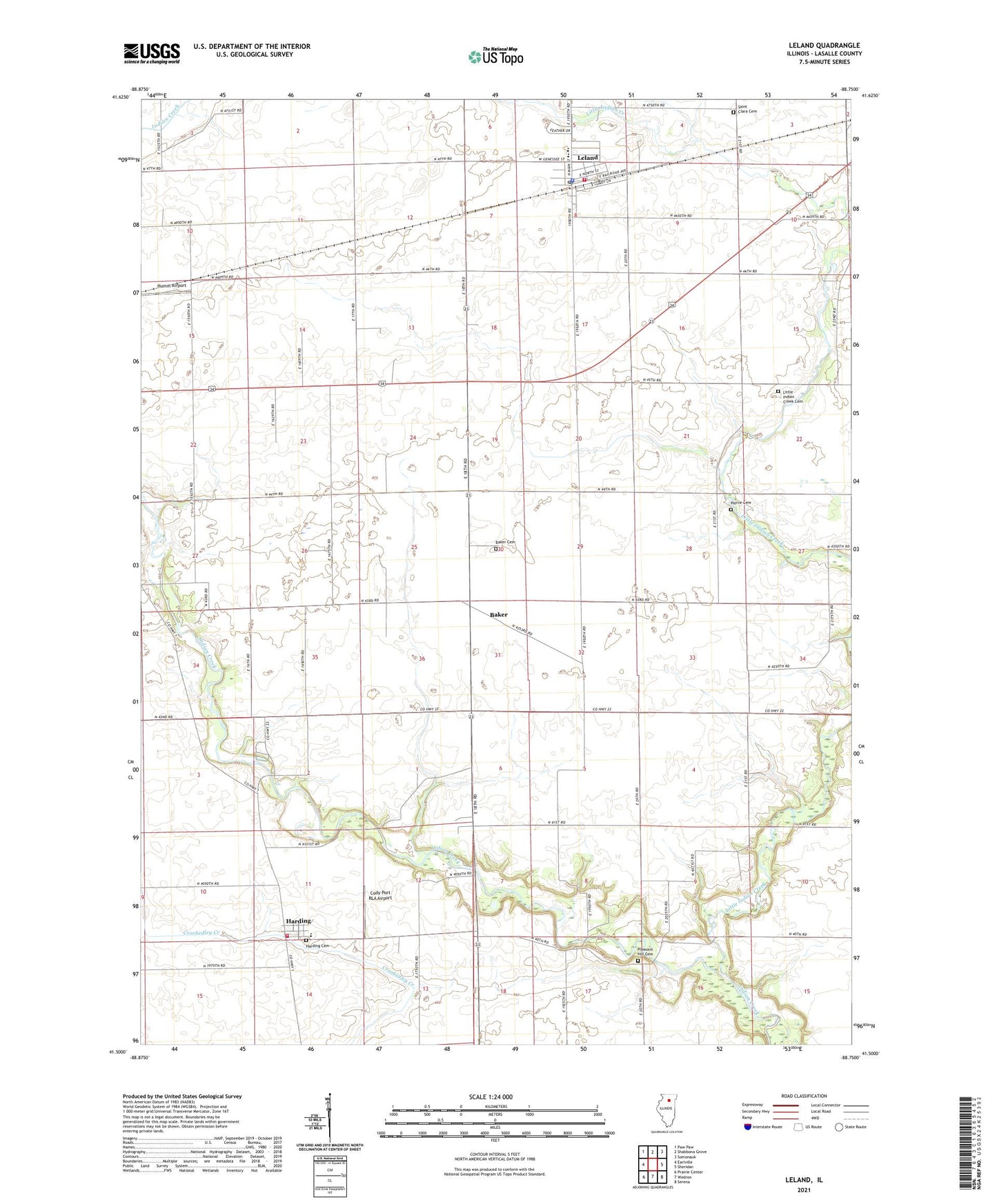
2024 topographic map quadrangle Leland in the state of Illinois. Scale: 1:24000. Based on the newly updated USGS 7.5' US Topo map series, this map is in the following counties: LaSalle. The map contains contour data, water features, and other items you are used to seeing on USGS maps, but also has updated roads and other features. This is the next generation of topographic maps. Printed on high-quality waterproof paper with UV fade-resistant inks.
Quads adjacent to this one:
West: Earlville
Northwest: Paw Paw
North: Shabbona Grove
Northeast: Somonauk
East: Sheridan
Southeast: Serena
South: Wedron
Southwest: Prairie Center
This map covers the same area as the classic USGS quad with code o41088e7.
Contains the following named places: Baker, Baker Cemetery, Cody Port RLA Airport, Harding, Harding Census Designated Place, Harding Grade School, Humm Airport, Leland, Leland Fire Protection District Station 1, Leland Fire Protection District Station 2, Leland High School, Leland Police Department, Leland Post Office, Little Indian Creek, Little Indian Creek Cemetery, Munson, Pierce Cemetery, Pleasant Hill Cemetery, Saint Clara Cemetery, Saint Petrie Church, Serena Fire Protection District Harding Station, Shabbona County Park, Township of Adams, Village of Leland, ZIP Code: 60531