MyTopo
Serena Illinois US Topo Map
Couldn't load pickup availability
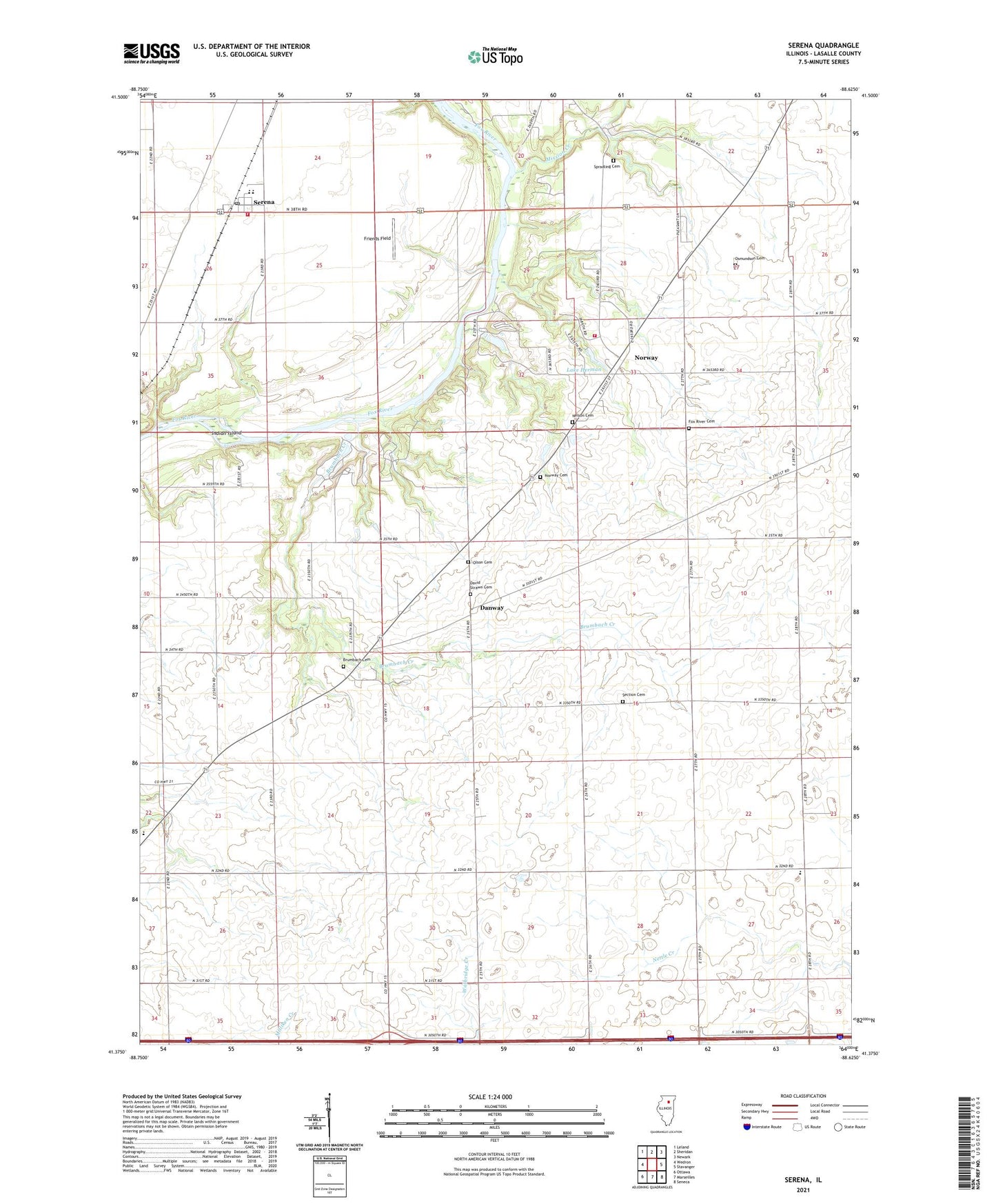
2024 topographic map quadrangle Serena in the state of Illinois. Scale: 1:24000. Based on the newly updated USGS 7.5' US Topo map series, this map is in the following counties: LaSalle. The map contains contour data, water features, and other items you are used to seeing on USGS maps, but also has updated roads and other features. This is the next generation of topographic maps. Printed on high-quality waterproof paper with UV fade-resistant inks.
Quads adjacent to this one:
West: Wedron
Northwest: Leland
North: Sheridan
Northeast: Newark
East: Stavanger
Southeast: Seneca
South: Marseilles
Southwest: Ottawa
This map covers the same area as the classic USGS quad with code o41088d6.
Contains the following named places: Armson School, Barber School, Brumbach Cemetery, Brumbach Creek, Camp Cloverleaf, Camp Merrybrook, Classon School, Danway, David Strawn Cemetery, Fox River Cemetery, Fox River Lutheran Church, Friends Field, Grove School, Hall School, Indian Island, Jim Wehrli Memorial Airport, Lake Herman, Lake Herman Dam, Lang School, Latter Day Saints Church, Longview Airport, Lower Fox River - Blakes Landing Nature Preserve, Milton Pope Elementary School, Mission Creek, Nelson Cemetery, Norway, Norway Cemetery, Norwegian Settlers State Memorial, Olson Cemetery, Osmundson Cemetery, Prairie Lake Hunt Club Airport, Rosedale School, Rutland Elementary School, Section Cemetery, Section School, Serena, Serena Census Designated Place, Serena Community Fire Protection District Main Station, Serena Elementary School, Serena Fire Protection District Norway Station 2, Serena High School, Serena Post Office, Serena United Methodist Church, Sheridan School, Spradling Cemetery, Township of Miller, Township of Rutland, Viking Campground, Wilderness Campground