MyTopo
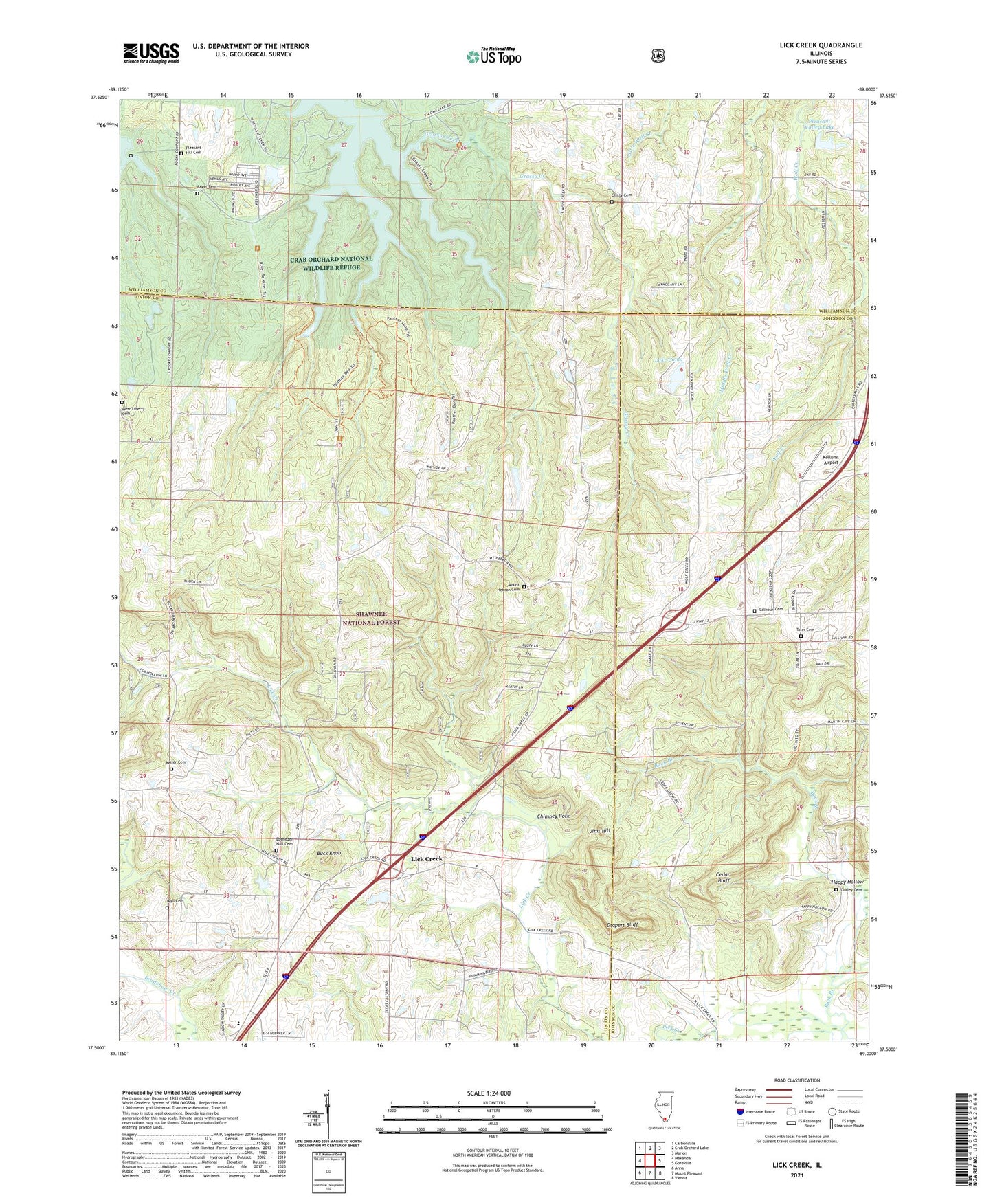
Lick Creek Illinois US Topo Map
Couldn't load pickup availability
Also explore the Lick Creek Forest Service Topo of this same quad for updated USFS data
2024 topographic map quadrangle Lick Creek in the state of Illinois. Scale: 1:24000. Based on the newly updated USGS 7.5' US Topo map series, this map is in the following counties: Union, Johnson, Williamson. The map contains contour data, water features, and other items you are used to seeing on USGS maps, but also has updated roads and other features. This is the next generation of topographic maps. Printed on high-quality waterproof paper with UV fade-resistant inks.
Quads adjacent to this one:
West: Makanda
Northwest: Carbondale
North: Crab Orchard Lake
Northeast: Marion
East: Goreville
Southeast: Vienna
South: Mount Pleasant
Southwest: Anna
This map covers the same area as the classic USGS quad with code o37089e1.
Contains the following named places: Baker Cemetery, Blue Sky Vineyard, Bluff School, Brooks School, Buck Knob, Calhoun Cemetery, Cedar Bluff, Cedar Bluff School, Cedar Grove Church, Chimney Rock, Chitty Cemetery, Crab Orchard Wilderness, Cumberland Church, Drapers Bluff, Drapers Bluff Point of Interest, Ebenezer Hall Cemetery, Fellowship Church, Goreville Number 1 Election Precinct, Gurley Cemetery, Happy Hollow, Houseman Airport, Illinois No Name Number 2001 Dam, Jims Hill, Keller Cemetery, Kellums Airport, Lake Como, Lake Como Dam, Liberty Church, Lick Creek, Lick Creek Church, Lick Creek Election Precinct, Lick Creek Elementary School, Low Gap School, Mount Hebron Cemetery, Mount Hebron Church, Mount Joy Church, Old Pleasant Hill Cemetery, Palestine Church, Panther Den Wilderness, Pendleman School, Pleasant Hill Cemetery, Pleasant Hill Church, Pleasant Valley Lake, Pleasant Valley Lake Dam, Poplar Grove School, Progress, Red Bud School, Regent School, The Hall, Toler Cemetery, Truelove School, Wall Cemetery, Wayside, West Liberty Cemetery, Wolf Creek School, WTCT-TV (Marion)