MyTopo
Maunie Illinois US Topo Map
Couldn't load pickup availability
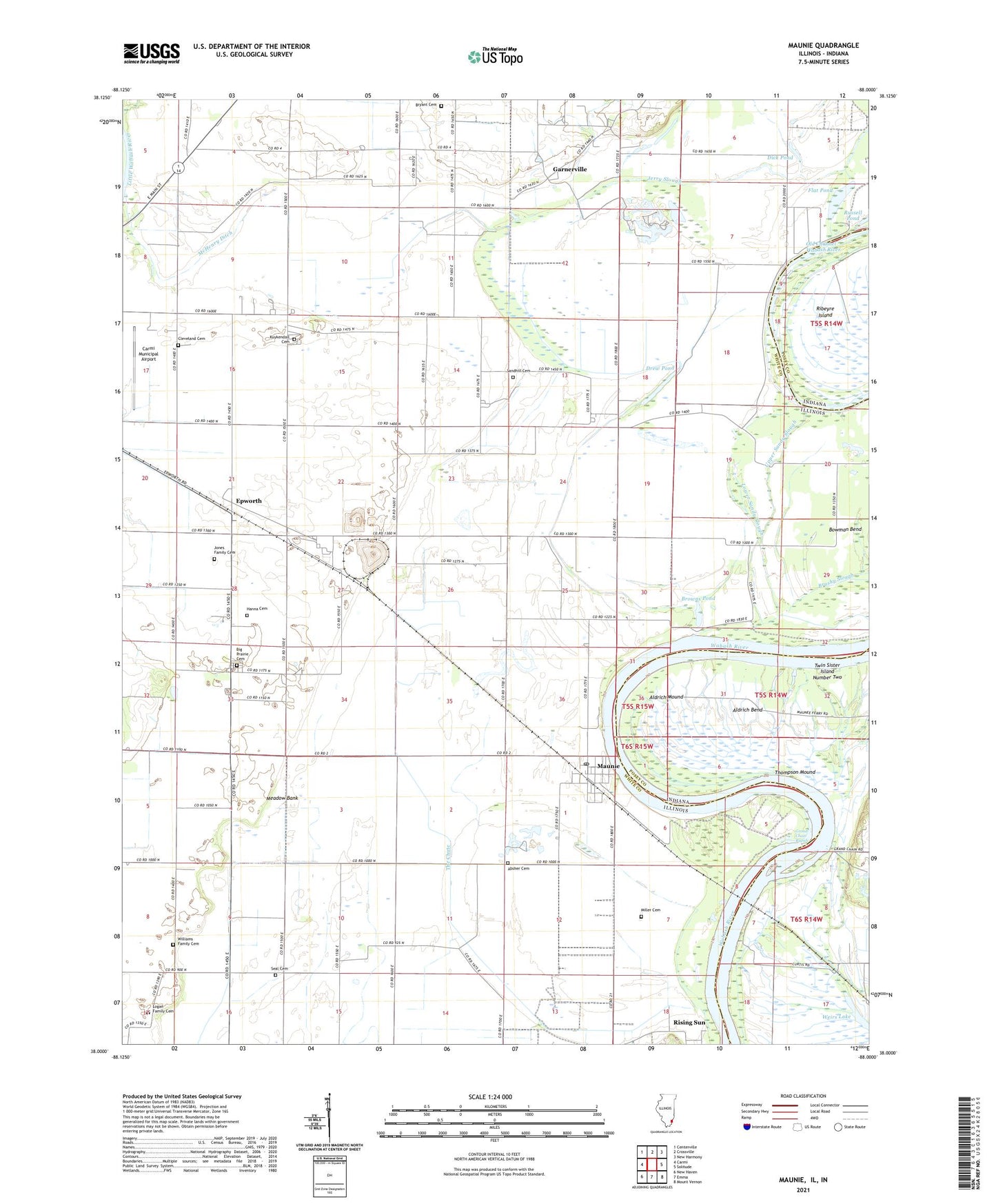
2024 topographic map quadrangle Maunie in the states of Illinois, Indiana. Scale: 1:24000. Based on the newly updated USGS 7.5' US Topo map series, this map is in the following counties: White, Posey. The map contains contour data, water features, and other items you are used to seeing on USGS maps, but also has updated roads and other features. This is the next generation of topographic maps. Printed on high-quality waterproof paper with UV fade-resistant inks.
Quads adjacent to this one:
West: Carmi
Northwest: Centerville
North: Crossville
Northeast: New Harmony
East: Solitude
Southeast: Mount Vernon
South: Emma
Southwest: New Haven
Contains the following named places: Absher Cemetery, Aldrich Bend, Aldrich Mound, Big Prairie Cemetery, Big Prairie School, Bowling Cemetery, Brown School, Browns Pond, Browns Pond Ditch, Brownsport, Brushy Slough, Bryant Cemetery, Carmi Air Force Station, Carmi Municipal Airport, Cleveland Cemetery, Cleveland School, Concord Oil Field, Dick Pond, Drew Pond, Duck Pond School, Elmgrove School, Epworth, Flat Pond, Garnerville, Georgia Church, Georgia School, Grand Chain Rapids, Hanna Cemetery, Hawthorne Ditch, Jerry Slough, Jones Family Cemetery, Kuykendall Cemetery, Logan Family Cemetery, Lower Sandy Slough, Maunie, Maunie North Oil Field, Maunie Post Office, Maunie South Oil Field, McHenry Church, McHenry Ditch, McHenry Slough, Meadow Bank, Miller Cemetery, New Harmony Oil Field, Old Channel Wabash River, Rising Sun, Rudolph School, Sandhill Cemetery, Seal Cemetery, Seal Church, Seal School, Simpson School, Simpson Switch, The Chute, Thompson Mound, Township of Hawthorne, Twin Sister Island Number Two, Upper Sandy Slough, Village of Maunie, Wabash Levee, Wabash Levee Ditch, Weirs Lake, Welborn Switch, Williams Family Cemetery, ZIP Code: 62861