MyTopo
Solitude Indiana US Topo Map
Couldn't load pickup availability
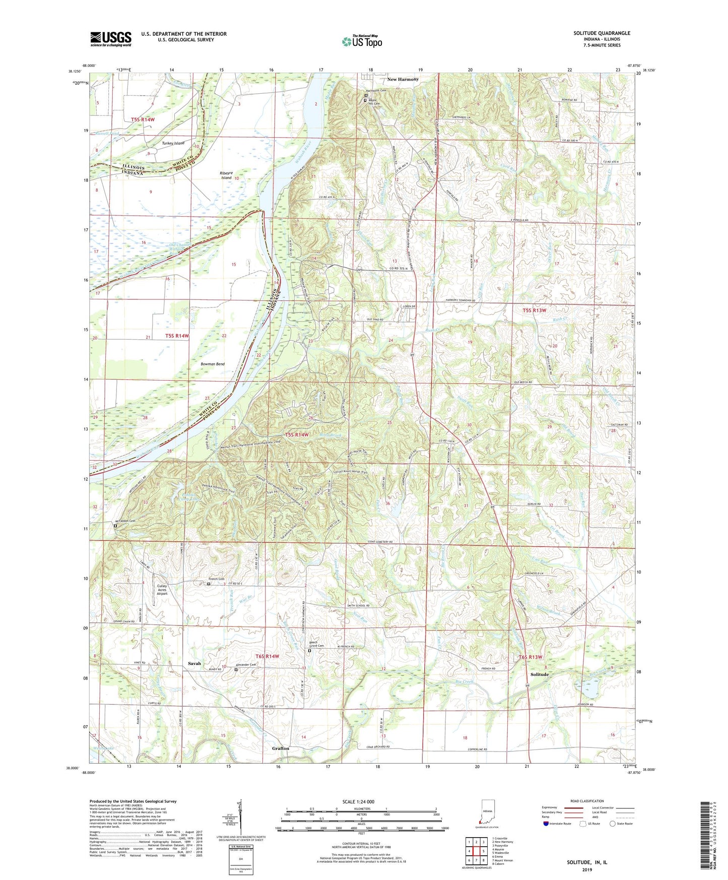
2022 topographic map quadrangle Solitude in the states of Indiana, Illinois. Scale: 1:24000. Based on the newly updated USGS 7.5' US Topo map series, this map is in the following counties: Posey, White. The map contains contour data, water features, and other items you are used to seeing on USGS maps, but also has updated roads and other features. This is the next generation of topographic maps. Printed on high-quality waterproof paper with UV fade-resistant inks.
Quads adjacent to this one:
West: Maunie
Northwest: Crossville
North: New Harmony
Northeast: Poseyville
East: Wadesville
Southeast: Caborn
South: Mount Vernon
Southwest: Emma
This map covers the same area as the classic USGS quad with code o38087a8.
Contains the following named places: Alexander Cemetery, Alexander Creek, Beech Grove Cemetery, Beech Grove Run, Bend Run, Bethesda Church, Bowman Bend, Camp Pahoka, Cord Run, Culley Acres Airport, Duo Run, Fox River, French Cemetery, French Run, Fun Creek, Gin Run, Goad Brook, Grafton, Ha Brook Creek, Harmonie State Park, Harmonist Cemetery, Hawthorne Creek, Large Drain, Long Run, Maple Hill Cemetery, Maple Run, McFadden Cemetery, Melody Run, Murphy Park, Nest Run, New Harmony State Memorial, Oka Run, Olive Chapel, Olive Creek, Oliver Run, Pahoka Camp Lake, Pahoka Camp Lake Dam, Pahoka Creek, Ribeyre Island, Road Brook, Rush Creek, Russell Pond, Savah, Solitude, Solitude Post Office, Solitude Run, Swift Run, The Labyrinth State Memorial, Thorn Run, Thrall Run, Township of Harmony, Township of Lynn, Turkey Island, Uno Run, Wabash River Old Channel, War Branch, Wilson Brook, Wilson Community Center, ZIP Code: 47631