MyTopo
Emma Illinois US Topo Map
Couldn't load pickup availability
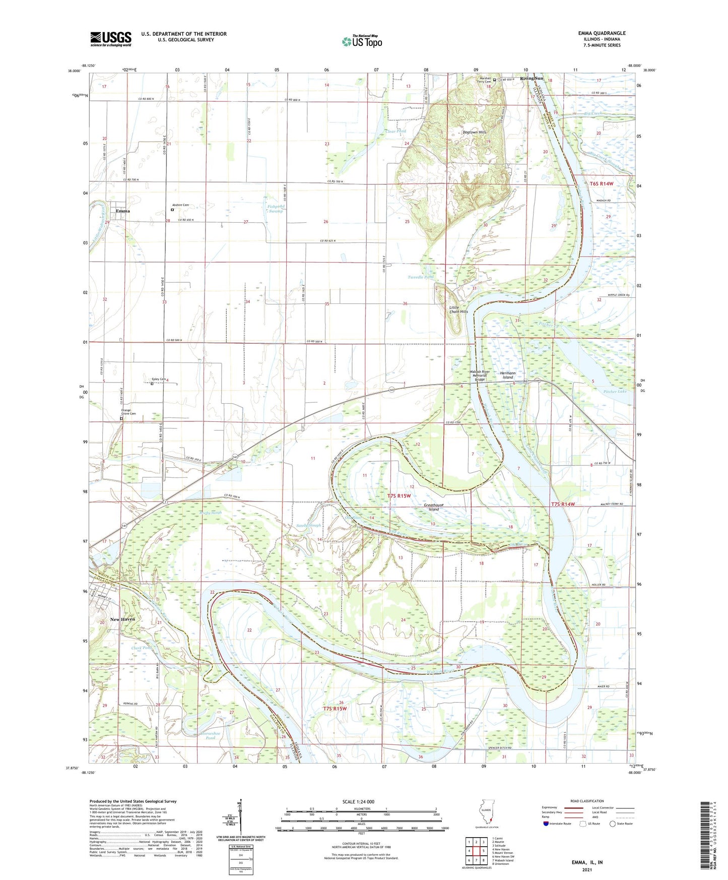
2024 topographic map quadrangle Emma in the states of Illinois, Indiana. Scale: 1:24000. Based on the newly updated USGS 7.5' US Topo map series, this map is in the following counties: White, Posey, Gallatin. The map contains contour data, water features, and other items you are used to seeing on USGS maps, but also has updated roads and other features. This is the next generation of topographic maps. Printed on high-quality waterproof paper with UV fade-resistant inks.
Quads adjacent to this one:
West: New Haven
Northwest: Carmi
North: Maunie
Northeast: Solitude
East: Mount Vernon
Southeast: Uniontown
South: Wabash Island
Southwest: New Haven SW
Contains the following named places: Abshire Cemetery, Big Creek, Big Creek Slough, Brushy Slough, Clark Pond, Clear Pond, Dogtown Ferry Public Fishing Site, Dogtown Hills, Elm Grove, Emma, Emma Concord Church, Epley Cemetery, Fishpond Swamp, Granny Tweedle Levee, Greathouse Island, Halfmoon Pond, Hermann Island, Horseshoe Pond, Little Chain Cutoff, Little Chain Hills, Little Wabash River, Marshall Ferry Cemetery, Old River, Old River Camp, Orange Grove Cemetery, Pitcher Lake, Sandy Slough, Township of Emma, Tweedle Pond, Wabash River Memorial Bridge, ZIP Code: 62867