MyTopo
Mendon Illinois US Topo Map
Couldn't load pickup availability
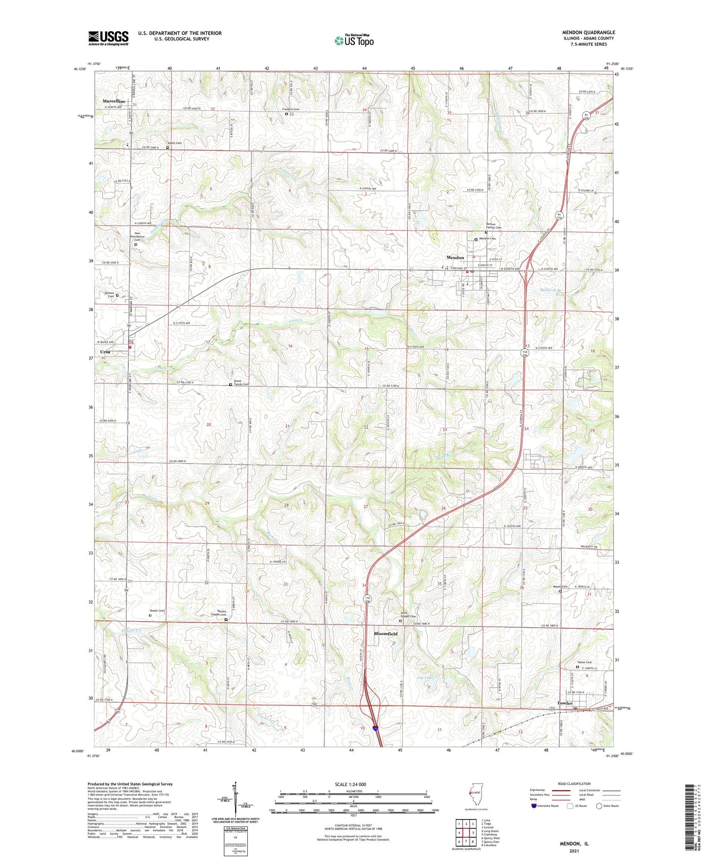
2024 topographic map quadrangle Mendon in the state of Illinois. Scale: 1:24000. Based on the newly updated USGS 7.5' US Topo map series, this map is in the following counties: Adams. The map contains contour data, water features, and other items you are used to seeing on USGS maps, but also has updated roads and other features. This is the next generation of topographic maps. Printed on high-quality waterproof paper with UV fade-resistant inks.
Quads adjacent to this one:
West: Long Island
Northwest: Lima
North: Tioga
Northeast: Loraine
East: Coatsburg
Southeast: Columbus
South: Quincy East
Southwest: Quincy West
This map covers the same area as the classic USGS quad with code o40091a3.
Contains the following named places: Adams County Ambulance - Mendon Station, Adams County Fairground, Bloomfield, Bloomfield Census Designated Place, Booth Cemetery, Brick School, Center School, Cramm Landing Area, Denson Cemetery, Dry Branch, Elm Grove School, First Congregational Church, Fowler, Fowler Census Designated Place, Fowler Post Office, Franklin Cemetery, Franklin School, Golden School, Greenfield Elementary School, Home Cemetery, Jug Lake, Jug Lake Dam, Keath Cemetery, Marcelline, Marcelline Census Designated Place, Mendon, Mendon Elementary School, Mendon Fire Department, Mendon Post Office, Mount Pleasant School, Moyer Cemetery, New Providence Cemetery, Saint Edward Church, Saint Joseph Cemetery, Sand Branch, Standard School, Star School, Stone Family Cemetery, Township of Mendon, Union School, Unity High School, Ursa, Ursa Christian Church, Ursa Fire Protection District, Ursa Post Office, Village of Mendon, Village of Ursa, Wesley Chapel Cemetery, Zion United Church of Christ, ZIP Code: 62351