MyTopo
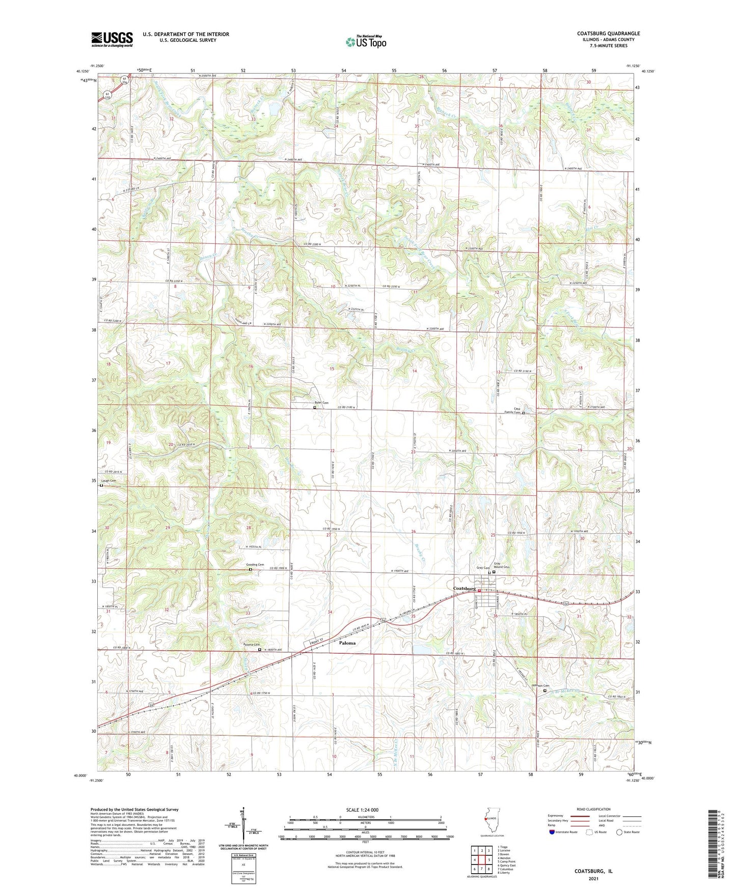
Coatsburg Illinois US Topo Map
Couldn't load pickup availability
2024 topographic map quadrangle Coatsburg in the state of Illinois. Scale: 1:24000. Based on the newly updated USGS 7.5' US Topo map series, this map is in the following counties: Adams. The map contains contour data, water features, and other items you are used to seeing on USGS maps, but also has updated roads and other features. This is the next generation of topographic maps. Printed on high-quality waterproof paper with UV fade-resistant inks.
Quads adjacent to this one:
West: Mendon
Northwest: Tioga
North: Loraine
Northeast: Bowen
East: Camp Point
Southeast: Liberty
South: Columbus
Southwest: Quincy East
This map covers the same area as the classic USGS quad with code o40091a2.
Contains the following named places: Adams County Farm, Baldwin Branch, Bigneck Creek, Brushy Creek, Brushy School, Byler Cemetery, Byler Cemetery Savanna Nature Preserve, Cate Family Cemetery, Center School, Central Adams County Fire Protection District, Coatsburg, Coffield School, Elm Creek, Glenwood School, Gooding Cemetery, Gray Mound Cemetery, Hog Branch, Honey Creek, Johnson Cemetery, Laugh Cemetery, Loraine Quarry, Lubbert Farm, Mealiff Landing Strip, Morton School, Mount Vernon School, Oakwood School, Paloma, Paloma Cemetery, Paloma Census Designated Place, Paloma Post Office, Paloma United Methodist Church, Richland School, Rocky Hill School, Saint Peters Lutheran Church, Township of Honey Creek, Village of Coatsburg, ZIP Codes: 62325, 62359