MyTopo
Columbus Illinois US Topo Map
Couldn't load pickup availability
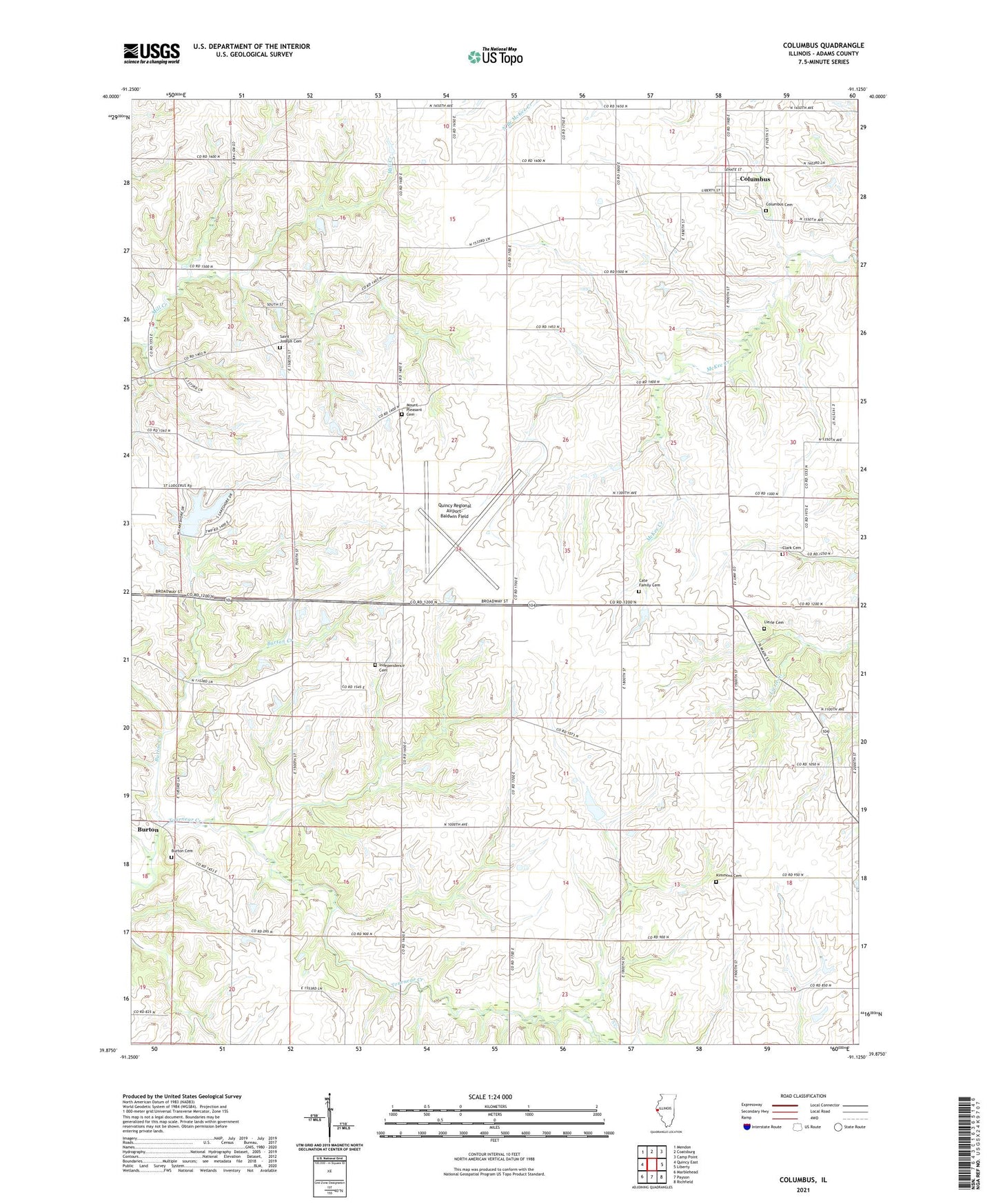
2024 topographic map quadrangle Columbus in the state of Illinois. Scale: 1:24000. Based on the newly updated USGS 7.5' US Topo map series, this map is in the following counties: Adams. The map contains contour data, water features, and other items you are used to seeing on USGS maps, but also has updated roads and other features. This is the next generation of topographic maps. Printed on high-quality waterproof paper with UV fade-resistant inks.
Quads adjacent to this one:
West: Quincy East
Northwest: Mendon
North: Coatsburg
Northeast: Camp Point
East: Liberty
Southeast: Richfield
South: Payson
Southwest: Marblehead
This map covers the same area as the classic USGS quad with code o39091h2.
Contains the following named places: Adams County, Burton, Burton Cave Nature Preserve, Burton Cemetery, Burton Census Designated Place, Burton Townhall, Columbus, Columbus Cemetery, Douglas School, Franklin School, Gilmer Townhall, Independence Cemetery, Independent School, Kimmons Cemetery, Lakeshore Hills Lake, Lakeshore Hills Lake Dam, Lierle Cemetery, Livingston School, Maple Grove School, Mount Pleasant Cemetery, Mount Pleasant Church, Mount Pleasant School, Pleasant Grove Church, Prairie School, Quincy Regional Airport-Baldwin Field, Saint Joseph Cemetery, Saint Joseph School, Seigel School, Tournear Creek, Township of Burton, Township of Gilmer, Village of Columbus, West Union School, ZIP Code: 62338