MyTopo
Middlesworth Illinois US Topo Map
Couldn't load pickup availability
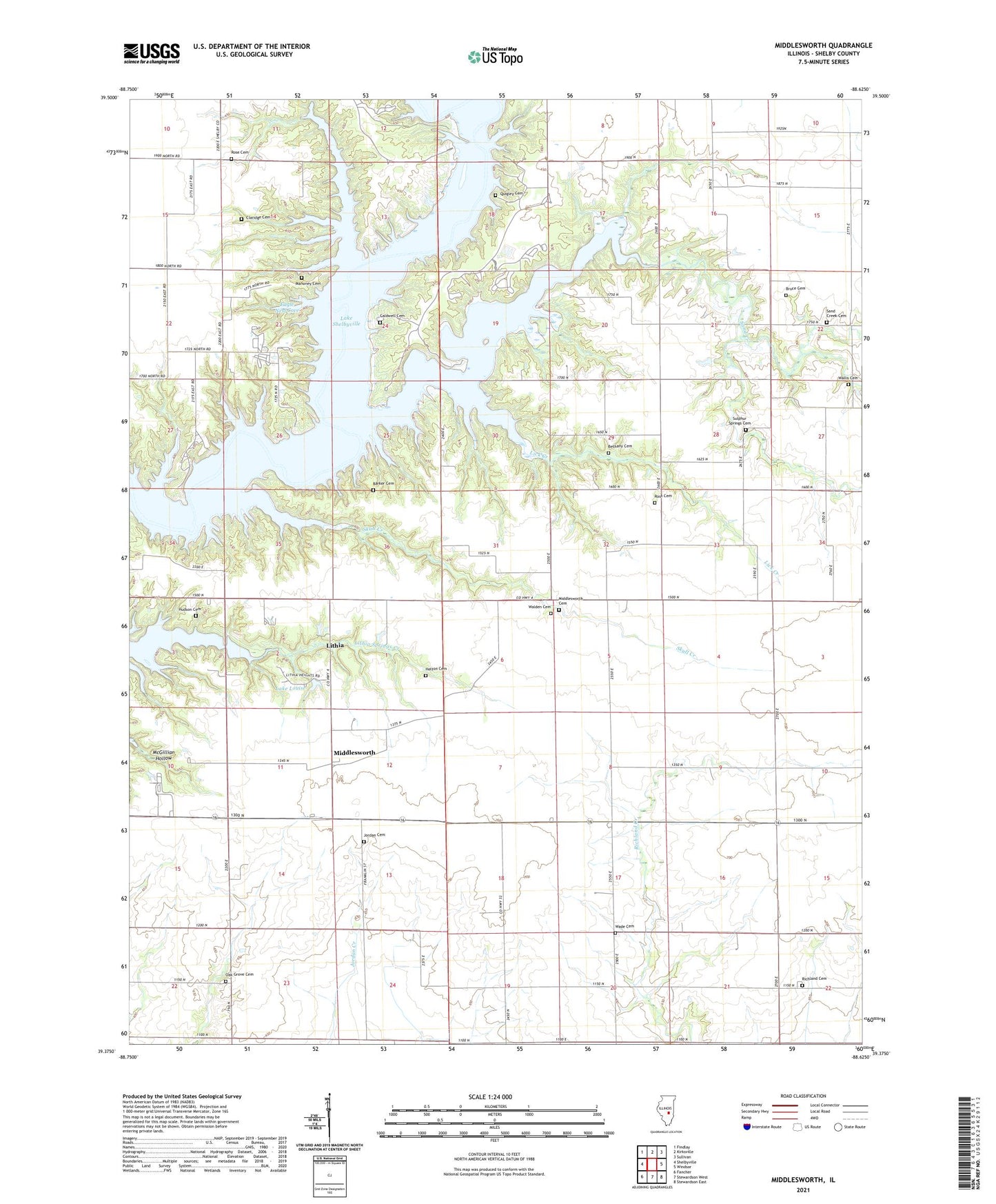
2024 topographic map quadrangle Middlesworth in the state of Illinois. Scale: 1:24000. Based on the newly updated USGS 7.5' US Topo map series, this map is in the following counties: Shelby. The map contains contour data, water features, and other items you are used to seeing on USGS maps, but also has updated roads and other features. This is the next generation of topographic maps. Printed on high-quality waterproof paper with UV fade-resistant inks.
Quads adjacent to this one:
West: Shelbyville
Northwest: Findlay
North: Kirksville
Northeast: Sullivan
East: Windsor
Southeast: Stewardson East
South: Stewardson West
Southwest: Fancher
This map covers the same area as the classic USGS quad with code o39088d6.
Contains the following named places: Barker Cemetery, Bethany Cemetery, Bethany Church, Bruce Cemetery, Caldwell Cemetery, Claridge Cemetery, Dugout School, Eagle Creek, Eagle Creek State Park, Eagle Nest Cove, Fletcher Church, Helton Cemetery, Hudson Cemetery, Jordan Cemetery, Jordan Chapel, Lake Louise, Lick Creek, Lithia, Lithia Post Office, Lone Point Access Area, Mahoney Cemetery, Mahoney School, Middlesworth, Middlesworth Cemetery, North Liberty School, Oak Grove Cemetery, Oak Grove Church, Quigley Cemetery, Richland Cemetery, Richland Church, Root Cemetery, Rose Cemetery, Sand Creek, Sand Creek Cemetery, Sand Creek Church, Skull Creek, South Liberty School, Sulphur Springs Cemetery, Sulphur Springs Church, Township of Richland, Township of Windsor, Wade Cemetery, Walden Cemetery, Wallis Cemetery, Wolf Creek State Park