MyTopo
Stewardson East Illinois US Topo Map
Couldn't load pickup availability
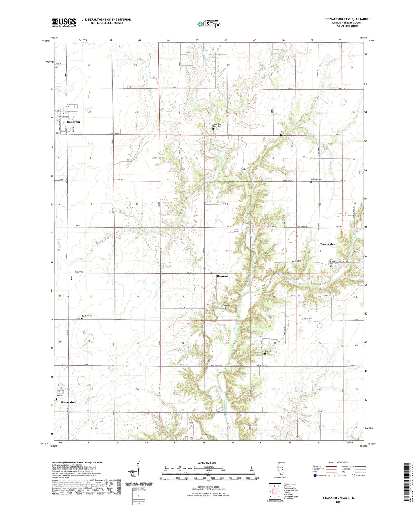
2024 topographic map quadrangle Stewardson East in the state of Illinois. Scale: 1:24000. Based on the newly updated USGS 7.5' US Topo map series, this map is in the following counties: Shelby. The map contains contour data, water features, and other items you are used to seeing on USGS maps, but also has updated roads and other features. This is the next generation of topographic maps. Printed on high-quality waterproof paper with UV fade-resistant inks.
Quads adjacent to this one:
West: Stewardson West
Northwest: Middlesworth
North: Windsor
Northeast: Mattoon West
East: Neoga
Southeast: Teutopolis
South: Effingham North
Southwest: Shumway
This map covers the same area as the classic USGS quad with code o39088c5.
Contains the following named places: Anderson Cemetery, Big Spring Post Office, Bills Creek, Brush Creek, Center School, Coons Cemetery, Copperas Creek, Drake Creek, Gaskill Cemetery, Gaskill Chapel, Grace Lutheran Church, Hiatt School, Kingman, Liberty Church, Lower Ash Grove Cemetery, Lower Ash Grove Church, Neoga Church, Rincker Cemetery, Saint Patricks Cemetery, Saint Patricks Church, Sexson Branch, South Strasburg, Spain Cemetery, Stewardson-Strasburg High School, Strasburg, Strasburg Fire Protection District, Strasburg Post Office, Strasburg United Methodist Church, Swedish Lutheran Cemetery, Township of Big Spring, Trinity Lutheran Church, Trinity Lutheran School, Trowbridge, Union School, Village of Strasburg, Wabash School, West Branch Little Wabash River, Wittenberg Airport, ZIP Code: 62463