MyTopo
Kirksville Illinois US Topo Map
Couldn't load pickup availability
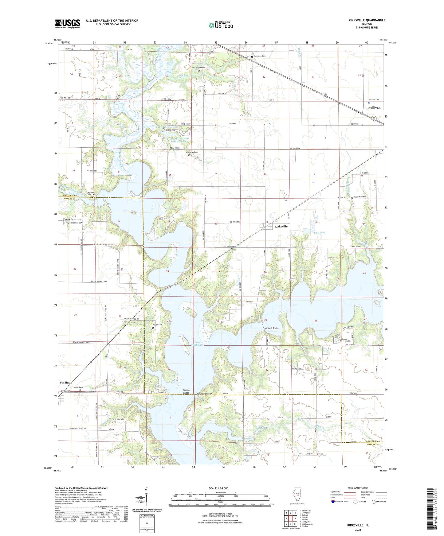
2024 topographic map quadrangle Kirksville in the state of Illinois. Scale: 1:24000. Based on the newly updated USGS 7.5' US Topo map series, this map is in the following counties: Moultrie, Shelby. The map contains contour data, water features, and other items you are used to seeing on USGS maps, but also has updated roads and other features. This is the next generation of topographic maps. Printed on high-quality waterproof paper with UV fade-resistant inks.
Quads adjacent to this one:
West: Findlay
Northwest: Dalton City
North: Lovington
Northeast: Cadwell
East: Sullivan
Southeast: Windsor
South: Middlesworth
Southwest: Shelbyville
This map covers the same area as the classic USGS quad with code o39088e6.
Contains the following named places: Camfield Branch, Camfield Cemetery, Carter - Ellis Cemetery, Cemetery, Coal Shaft Bridge, Cook Bridge, Cook School, Countyline Bridge, Dunn Branch, Dunn School, Elim Lake, Elim Lake Dam, Elm Springs Park Lake Number 4, Elm Springs Park Lake Number 4 Dam, Emil Lake, Emil Lake Dam, Findlay Bridge, Findlay Cemetery, Forest School, Hampton Cemetery, Harmony School, Henderson Cemetery, Howell Bridge, Independence School, Kirksville, Lake Shelbyville, Maple Grove School, Marrowbone Creek, Moultrie County Sheriff's Office, Nazworthy School, New Liberty Church, Oak Grove Cemetery, Oak Grove Church, Reedy School, School Number 9, Timber Lake Golf Course, Township of Sullivan, Turney School, Union School, West Hudson School, West Okaw River, West Okaw River State Fish and Wildlife Management Area, Whitley Creek Recreation Area, Wilborn Creek, Wilborn Creek Cemetery, Wilborn Creek Recreation Area, Wolf Creek, Wright Cemetery