MyTopo
Sandford Indiana US Topo Map
Couldn't load pickup availability
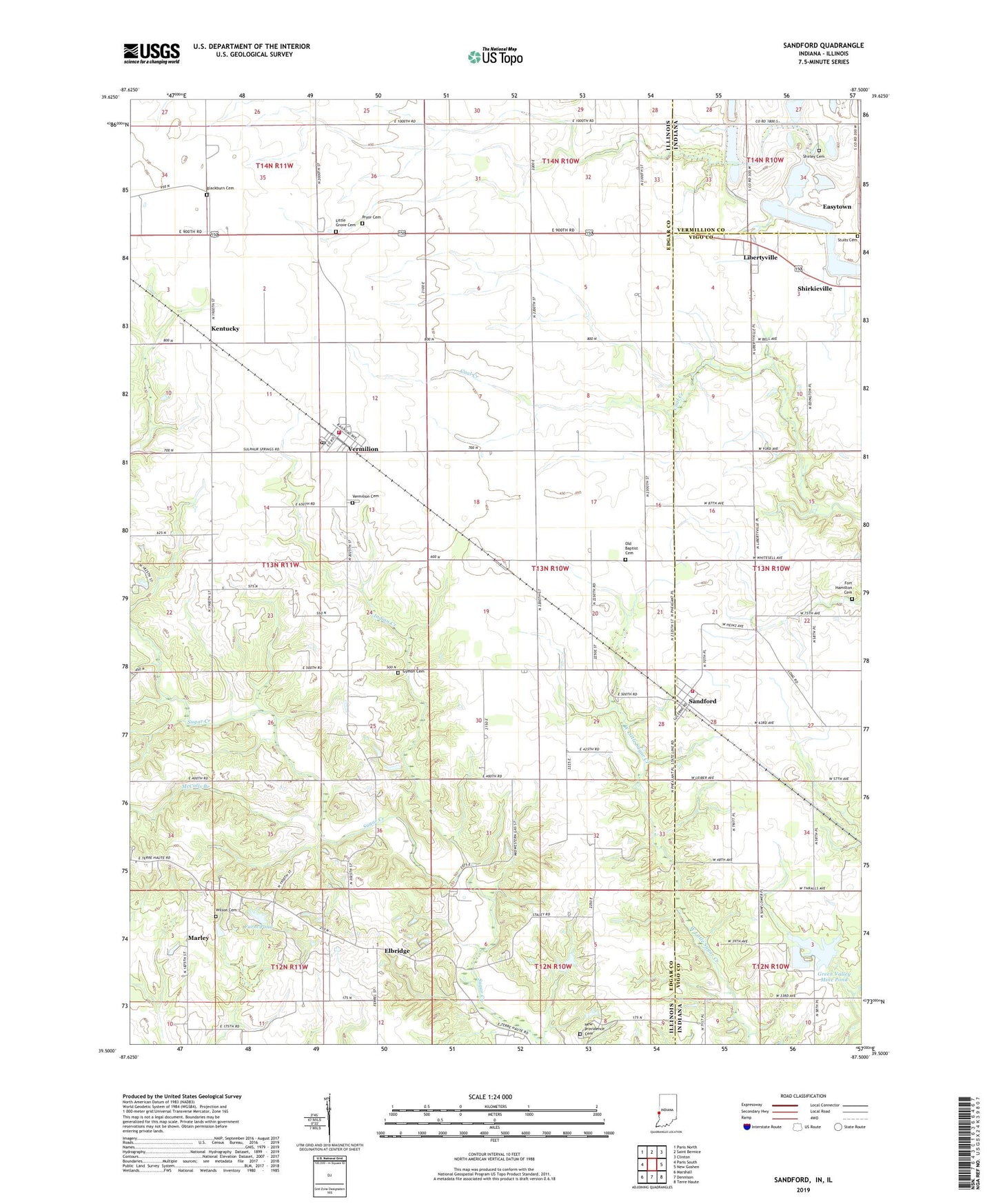
2022 topographic map quadrangle Sandford in the states of Illinois, Indiana. Scale: 1:24000. Based on the newly updated USGS 7.5' US Topo map series, this map is in the following counties: Vigo, Edgar, Vermillion. The map contains contour data, water features, and other items you are used to seeing on USGS maps, but also has updated roads and other features. This is the next generation of topographic maps. Printed on high-quality waterproof paper with UV fade-resistant inks.
Quads adjacent to this one:
West: Paris South
Northwest: Paris North
North: Saint Bernice
Northeast: Clinton
East: New Goshen
Southeast: Terre Haute
South: Dennison
Southwest: Marshall
This map covers the same area as the classic USGS quad with code o39087e5.
Contains the following named places: Blackburn Cemetery, Easytown, Elbridge, Elbridge Oil Field, Farm Pond, Farm Pond Dam, Fayette Township Volunteer Fire Department of Sandford, Fort Hamilton Cemetery, Gin Creek, Grand Central School, Grand Success School, Green Valley Mine Pond, Green Valley Mine Pond Dam, Green Valley Public Fishing Area, Guymon Cemetery, Indian Creek, Kentucky, Kentucky School, Lake Wannetta, Lake Wannetta Dam, Libertyville, Little Grove Cemetery, Little Grove Church, Marley, McCalls Branch, New Providence Cemetery, New Providence Church, New Providence School, Old Baptist Cemetery, Pisgah Church, Pryor Cemetery, Rose Hill Church, Sandford, School Number 7, Shirkie Mine Pond, Shirley Cemetery, Stults Cemetery, Success Church, Success School, Superior School, Tighe, Township of Elbridge, Township of Stratton, Vermilion, Vermilion Cemetery, Vermilion Fire Department, Vermilion Post Office, Village of Vermilion, West Sandford, Wilson Cemetery, ZIP Code: 61955