MyTopo
Pearl East Illinois US Topo Map
Couldn't load pickup availability
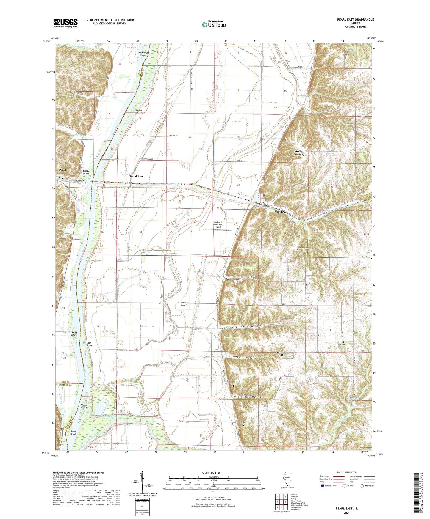
2024 topographic map quadrangle Pearl East in the state of Illinois. Scale: 1:24000. Based on the newly updated USGS 7.5' US Topo map series, this map is in the following counties: Greene, Pike, Calhoun. The map contains contour data, water features, and other items you are used to seeing on USGS maps, but also has updated roads and other features. This is the next generation of topographic maps. Printed on high-quality waterproof paper with UV fade-resistant inks.
Quads adjacent to this one:
West: Pearl West
Northwest: Milton
North: Bedford
Northeast: Alsey
East: Roodhouse West
Southeast: Carrollton
South: Kampsville
Southwest: Pleasant Dale Valley
This map covers the same area as the classic USGS quad with code o39090d5.
Contains the following named places: Bee Creek, Bettell Creek, Bishop Dale School, Bluefield Cemetery, Bridge Island, Bridgewater Cemetery, Bridgewater Hollow, Brushy Lake, Buckhorn Creek, Buckhorn Island, Clark Lake, Coates School, Dougal Hollow, East Brushy School, Fisher Island, Garrison Hollow, Grand Pass, Hartwell Pumping Station, Hartwell Ranch, Hartwell Ranch RLA Airport, Hill Creek, Hillview, Hillview Number 1 Quarry, Hurricane Creek, Kersey Creek, Kinser Cemetery, Lake View School, Likely Cemetery, Long Lake, Lower Sand Ridge School, Martin Airport, McClay Orchard, McWilliams School, Oakdale School, Old Settlers Spring, Orton Landing Field, Paar Cemetery, Scott Hollow, Shelton Cemetery, Spar Island, Sweeten Cemetery, Township of Patterson, Township of Walkerville, Twin Islands, Upper Sand Ridge School, Village of Hillview, Village of Pearl, Weson Island, West Brushy School, Wing Island, ZIP Code: 62050