MyTopo
Pleasant Hill East Illinois US Topo Map
Couldn't load pickup availability
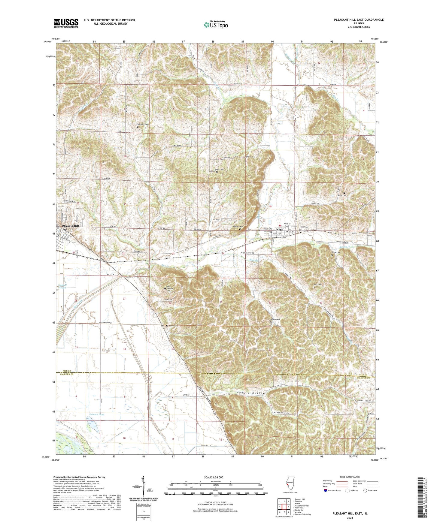
2024 topographic map quadrangle Pleasant Hill East in the state of Illinois. Scale: 1:24000. Based on the newly updated USGS 7.5' US Topo map series, this map is in the following counties: Pike, Calhoun. The map contains contour data, water features, and other items you are used to seeing on USGS maps, but also has updated roads and other features. This is the next generation of topographic maps. Printed on high-quality waterproof paper with UV fade-resistant inks.
Quads adjacent to this one:
West: Pleasant Hill West
Northwest: Summer Hill
North: Pittsfield
Northeast: Milton
East: Pearl West
Southeast: Pleasant Dale Valley
South: Annada
Southwest: Clarksville
This map covers the same area as the classic USGS quad with code o39090d7.
Contains the following named places: Allison Cemetery, Bay Creek Diversion Ditch, Bayville School, Buck Branch, Buckeye Creek, Carrollton Ridge Church, Cold Run, Cold Run School, Crooked Slough, Dolman Pond, Elm Grove School, Farmers Ridge School, Franklin School, Fruit Ridge School, Hack Cemetery, Hackberry School, Hartsock Cemetery, Haulford School, Henry Cemetery, Hollis Cemetery, Honey Creek, Howell Hollow, Hutton Cemetery, Jacksonville School, Lakeview School, Mason Cemetery, Nebo, Nebo Baptist Church, Nebo Cemetery, Nebo Post Office, Neese Cemetery, New Venable Cemetery, Oakland School, Old Baptist School, Pleasant Hill, Pleasant Hill Baptist Church, Pleasant Hill Christian Church, Pleasant Hill Elementary School, Pleasant Hill High School, Pleasant Hill Post Office, Round Pond, Sideview School, Spring Creek, Spring Creek Fire Protection District, Township of Pleasant Hill, Twin Ponds, Village of Nebo, Village of Pleasant Hill, ZIP Code: 62355