MyTopo
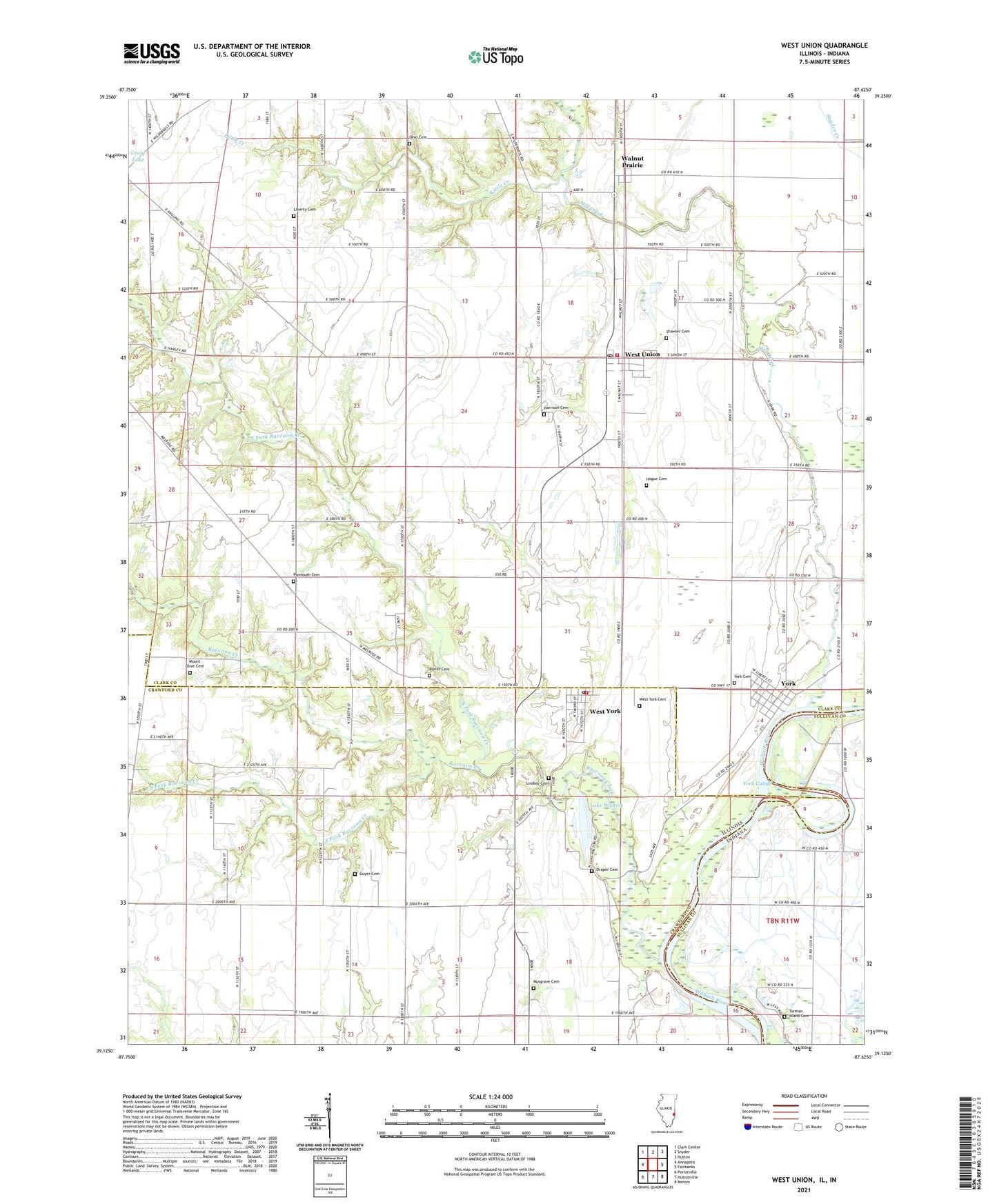
West Union Illinois US Topo Map
Couldn't load pickup availability
2024 topographic map quadrangle West Union in the states of Illinois, Indiana. Scale: 1:24000. Based on the newly updated USGS 7.5' US Topo map series, this map is in the following counties: Clark, Crawford, Sullivan. The map contains contour data, water features, and other items you are used to seeing on USGS maps, but also has updated roads and other features. This is the next generation of topographic maps. Printed on high-quality waterproof paper with UV fade-resistant inks.
Quads adjacent to this one:
West: Annapolis
Northwest: Clark Center
North: Snyder
Northeast: Hutton
East: Fairbanks
Southeast: Merom
South: Hutsonville
Southwest: Porterville
Contains the following named places: Bailiff Cemetery, Clark County Ambulance Service, Crow School, Draper Cemetery, Faith Church, Guyer Cemetery, Harrison Cemetery, Hogue Cemetery, Hutsonville Church, Hutsonville Power Station, Hutsonville Township Fire Protection District Station 2 West York, Lake Walton, Liberty Cemetery, Liberty School, Lindley Cemetery, Little Creek, Mill Creek, Mount Olive Baptist Church, Mount Olive Cemetery, Musgrave Cemetery, New Providence Church, North Fork Raccoon Creek, Ohio Cemetery, Ohio Chapel, Old Channel Lake, Pleasant Grove Church, Plymouth Cemetery, Potters Hall Church, Raccoon Creek, Shawler Cemetery, South Fork Raccoon Creek, Township of Melrose, Township of York, Turman Island Cemetery, Walnut Prairie, West Union, West Union Census Designated Place, West Union Community Fire Protection District, West Union Park, West Union Post Office, West York, West York Cemetery, West York Census Designated Place, York, York Cemetery, York Cutoff, York Ferry, ZIP Codes: 62477, 62478