MyTopo
Shannon Illinois US Topo Map
Couldn't load pickup availability
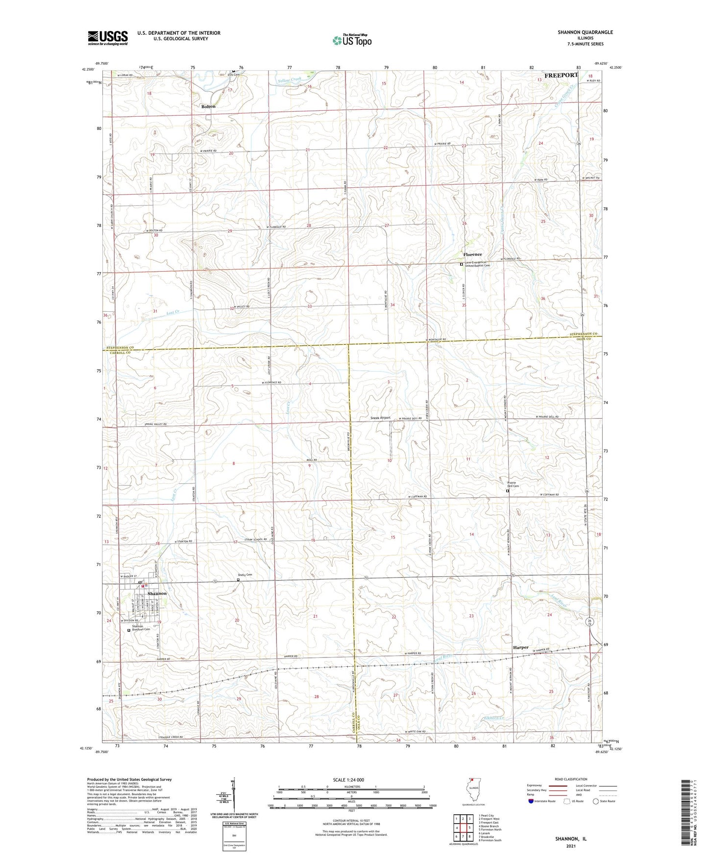
2024 topographic map quadrangle Shannon in the state of Illinois. Scale: 1:24000. Based on the newly updated USGS 7.5' US Topo map series, this map is in the following counties: Stephenson, Ogle, Carroll. The map contains contour data, water features, and other items you are used to seeing on USGS maps, but also has updated roads and other features. This is the next generation of topographic maps. Printed on high-quality waterproof paper with UV fade-resistant inks.
Quads adjacent to this one:
West: Boone Branch
Northwest: Pearl City
North: Freeport West
Northeast: Freeport East
East: Forreston North
Southeast: Forreston South
South: Brookville
Southwest: Lanark
This map covers the same area as the classic USGS quad with code o42089b6.
Contains the following named places: Bethel United Methodist Church, Bolton, Eastland Junior High School, Evergreen School, Florence, Gravel Hill School, Harper, Janssen Airport, Keller School, Lane Evangelical United Baptist Cemetery, Lost Creek School, May School, Moring Airport, Mount Union School, Pleasant Hill School, Pleasant View School, Prairie Dell Cemetery, Prairie Dell Church, Prairie Dell School, Saint Wendelins Catholic Church, Shannon, Shannon Ambulance Service, Shannon Baptist Church, Shannon Brethren Cemetery, Shannon City Hall, Shannon Fire Protection District, Shannon Police Department, Shannon Post Office, Shelly Cemetery, Sneek Airport, Swale Quarry, Township of Florence, Township of Forreston, Union School, Van Brocklin Church, Van Brocklin School, Village of Shannon, Wall School, ZIP Code: 61078