MyTopo
Forreston North Illinois US Topo Map
Couldn't load pickup availability
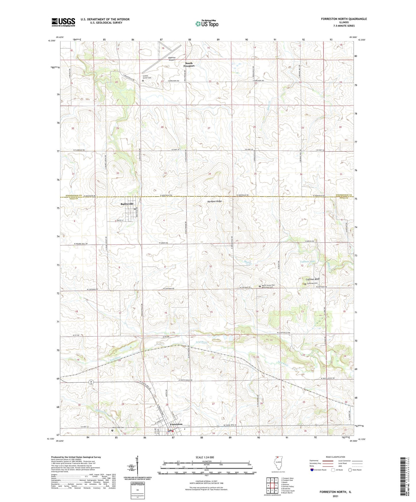
2024 topographic map quadrangle Forreston North in the state of Illinois. Scale: 1:24000. Based on the newly updated USGS 7.5' US Topo map series, this map is in the following counties: Ogle, Stephenson. The map contains contour data, water features, and other items you are used to seeing on USGS maps, but also has updated roads and other features. This is the next generation of topographic maps. Printed on high-quality waterproof paper with UV fade-resistant inks.
Quads adjacent to this one:
West: Shannon
Northwest: Freeport West
North: Freeport East
Northeast: Ridott
East: German Valley
Southeast: Mount Morris
South: Forreston South
Southwest: Brookville
This map covers the same area as the classic USGS quad with code o42089b5.
Contains the following named places: Albertus Airport, Baileyville, Baileyville Baptist Church, Baileyville Census Designated Place, Baileyville Post Office, Baileyville Reformed Church, Coffman Bluff, Coffman Cemetery, Coffman Lake, Collman School, Crane School, Cranes Grove Cemetery, Cyclone Heights School, Forreston, Forreston City Hall, Forreston Fire Protection District, Forreston High School, Forreston Post Office, Forreston Station, Gravel Pit School, Green Prairie School, Hardpan Ridge, Kutz Quarry, Maple Hill School, Myers Quarry, North Grove Church, North Grove Zion Reformed Cemetery, Oakdale Nature Preserve, Pleasant Hill School, Prairie Hill School, Rummel RLA Airport, Silver Creek Center School, South Freeport, Sunnyside School, Timber Ridge Mobile Home Park, Township of Maryland, Township of Silver Creek, Village of Forreston, White Oak Cemetery, White Oak School, ZIP Code: 61007