MyTopo
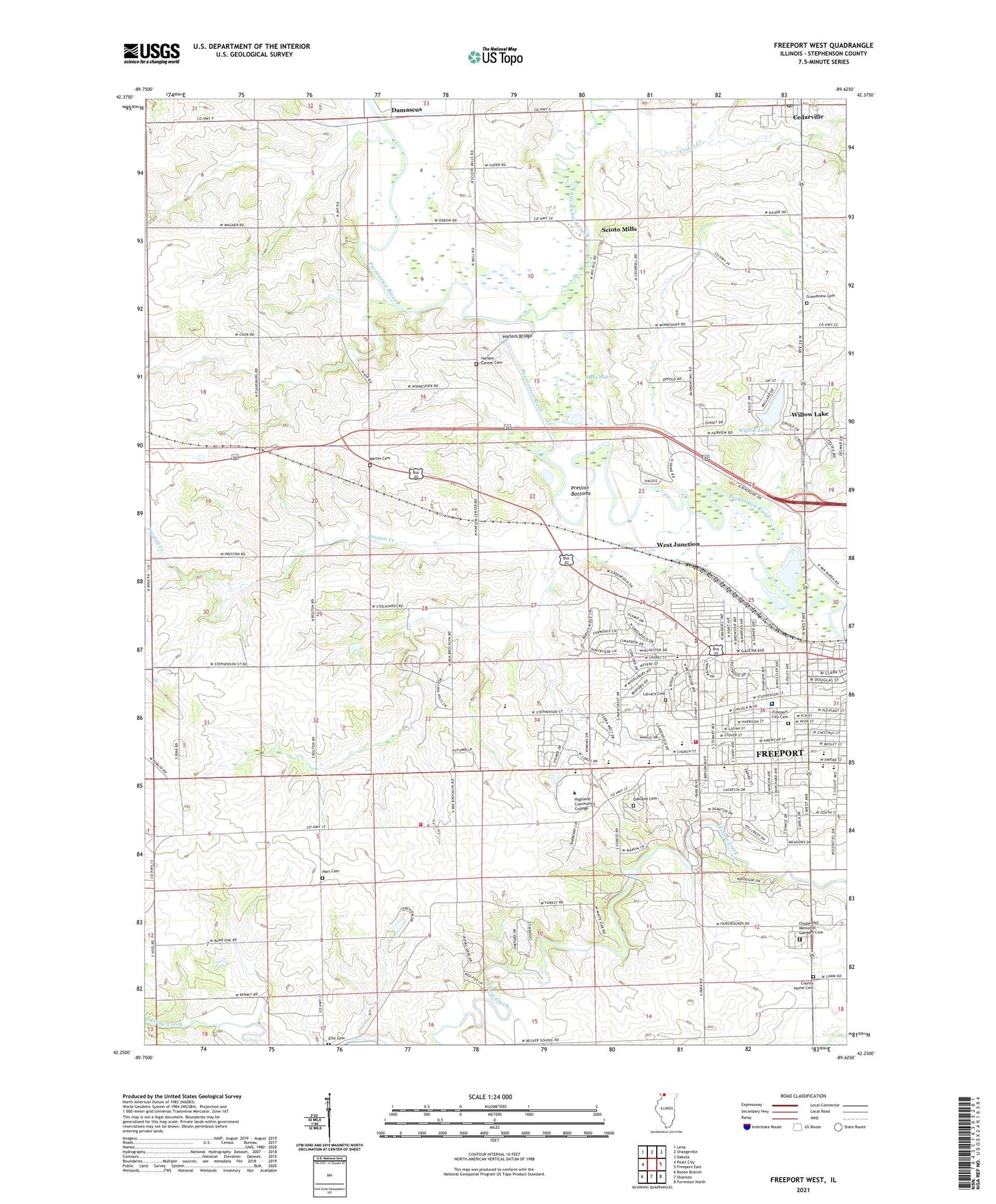
Freeport West Illinois US Topo Map
Couldn't load pickup availability
2024 topographic map quadrangle Freeport West in the state of Illinois. Scale: 1:24000. Based on the newly updated USGS 7.5' US Topo map series, this map is in the following counties: Stephenson. The map contains contour data, water features, and other items you are used to seeing on USGS maps, but also has updated roads and other features. This is the next generation of topographic maps. Printed on high-quality waterproof paper with UV fade-resistant inks.
Quads adjacent to this one:
West: Pearl City
Northwest: Lena
North: Orangeville
Northeast: Dakota
East: Freeport East
Southeast: Forreston North
South: Shannon
Southwest: Boone Branch
This map covers the same area as the classic USGS quad with code o42089c6.
Contains the following named places: Bavarian Village Shopping Center, Becker School, Bennis Drive-In, Bidwell Park, Calvary Cemetery, Carl Sandburg Upper Elementary School, Cedar Creek, Cedarville Post Office, Centennial School, Chapel Hill Memorial Gardens Cemetery, Church of the Brethren, City of Freeport, County Home Cemetery, Crestwood Shopping Center, Damascus, Damascus School, Ducks Misery, Ellis Cemetery, Empire Elementary School, F H N Memorial Hospital, Fairview School, First Church of the Open Bible, First United Brethren Church, Flansburg School, Freeport Christian Academy, Freeport City Cemetery, Freeport Clinic, Freeport Country Club, Freeport Fire Department Station 1, Freeport Fire Department Station 3, Freeport High School, Freeport Junior High School, Freeport Rural Ambulance, Freeport Rural Fire Protection District Station 3, Freeport Water Treatment Plant, Grandview Cemetery, Greenville School, Harlem Bridge, Harlem Center Cemetery, Harlem Center School, Harlem School, Hart Cemetery, Hart School, Highland Community College, Highland Community College Technical Center, Immanuel Lutheran School, Krape Park, Lincoln School, Lincoln Shopping Center, Lincoln-Douglas Elementary School, Macomber Farm, Martin Cemetery, Meadows Shopping Center, Memorial Heliport, Millerburg School, Nesbit School, Oakland Cemetery, Open Bible Church, Oppold Quarry, Park Hills Golf Course, Park Plaza Shopping Center, Pleasant Hill School, Preston Bottoms, Preston Creek, Prince of Peace Lutheran Church, Read Park, Richland Creek, Saint Thomas Aquinas Church, Saint Thomas School, Schofield School, Scioto Mills, Scioto Mills Post Office, Southwest Plaza Shopping Center, Star Ambulance, Stephenson County, Stephenson Mobile Home Estates, Township of Freeport, Township of Harlem, Wagner School, Wallace Yards, West Avenue Shopping Center, West Junction, WFPS-FM (Freeport), Willow Lake, Willow Lake Census Designated Place, Willow Lake Dam, ZIP Codes: 61013, 61032