MyTopo
Sorento South Illinois US Topo Map
Couldn't load pickup availability
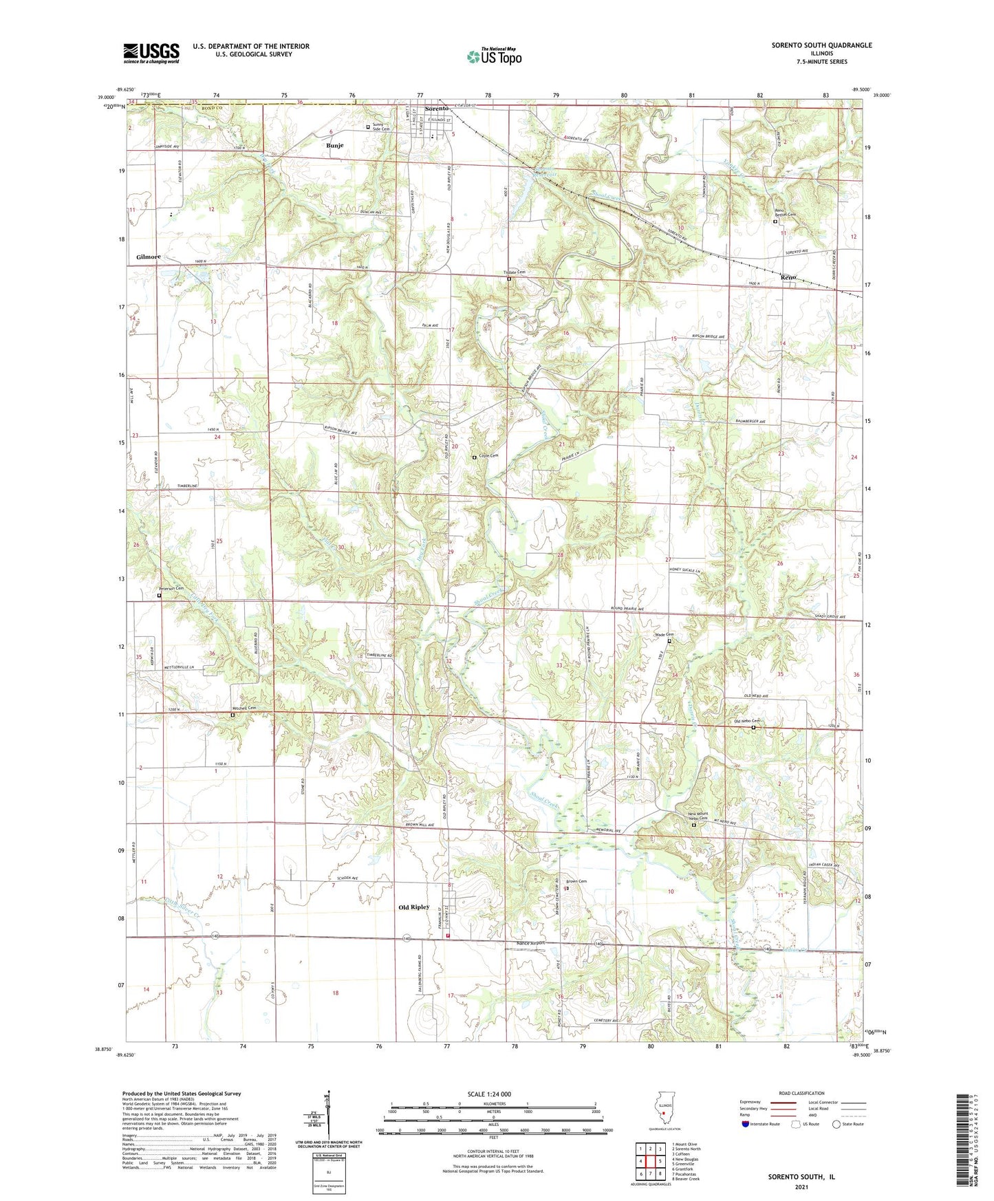
2024 topographic map quadrangle Sorento South in the state of Illinois. Scale: 1:24000. Based on the newly updated USGS 7.5' US Topo map series, this map is in the following counties: Bond, Montgomery. The map contains contour data, water features, and other items you are used to seeing on USGS maps, but also has updated roads and other features. This is the next generation of topographic maps. Printed on high-quality waterproof paper with UV fade-resistant inks.
Quads adjacent to this one:
West: New Douglas
Northwest: Mount Olive
North: Sorento North
Northeast: Coffeen
East: Greenville
Southeast: Beaver Creek
South: Pocahontas
Southwest: Grantfork
This map covers the same area as the classic USGS quad with code o38089h5.
Contains the following named places: Blackjack School, Brick School, Brown Cemetery, Bunje, Coyle Cemetery, Dorris Creek, Dry Fork, Elm Point Branch, Flat Creek, Gilmore, Indian Creek, Little Brick School, Little Dry Fork, Mitchell Cemetery, Mount Nebo Church, Nance Airport, New Mount Nebo Cemetery, Old Nebo Cemetery, Old Ripley, Peterson Cemetery, Pin Oak School, Pleasant Prairie Post Office, Pocahontas - Old Ripley Fire Protection District Station 2, Ray School, Reno, Reno Bethel Cemetery, Round Prairie School, Smith School, Sorento, Sorento Elementary School, Sorento Reservoir, Sorento Reservoir Dam, Sunny Side Cemetery, Terrapin Ridge School, Tisdale Cemetery, Township of Old Ripley, Township of Shoal Creek, Village of Old Ripley, Wade Cemetery, Willis School, Yankee Creek, ZIP Code: 62086