MyTopo
Mount Olive Illinois US Topo Map
Couldn't load pickup availability
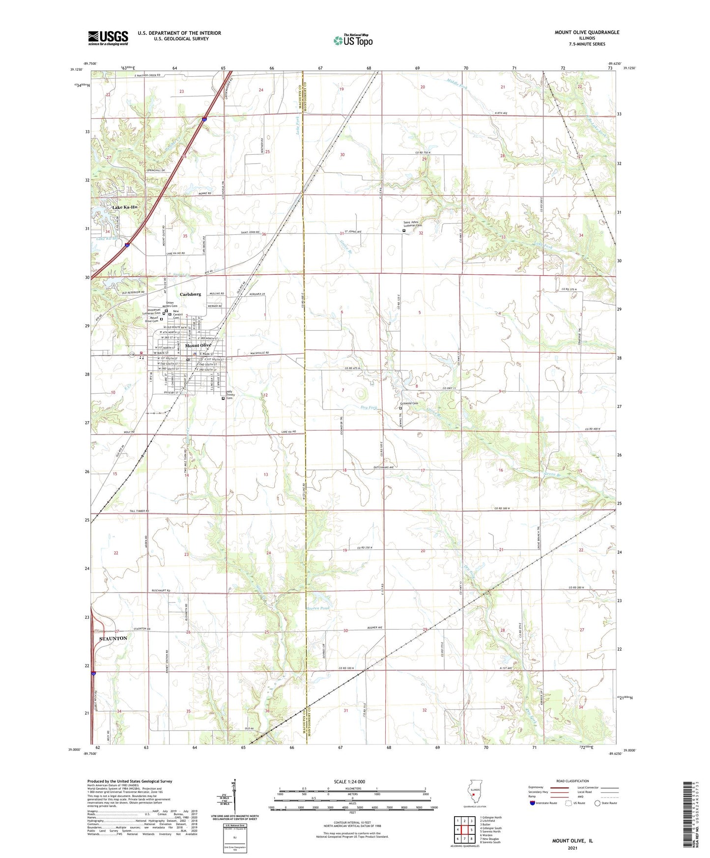
2024 topographic map quadrangle Mount Olive in the state of Illinois. Scale: 1:24000. Based on the newly updated USGS 7.5' US Topo map series, this map is in the following counties: Montgomery, Macoupin. The map contains contour data, water features, and other items you are used to seeing on USGS maps, but also has updated roads and other features. This is the next generation of topographic maps. Printed on high-quality waterproof paper with UV fade-resistant inks.
Quads adjacent to this one:
West: Gillespie South
Northwest: Gillespie North
North: Litchfield
Northeast: Butler
East: Sorento North
Southeast: Sorento South
South: New Douglas
Southwest: Worden
This map covers the same area as the classic USGS quad with code o39089a6.
Contains the following named places: Brokaw School, Carlsburg, City of Mount Olive, Davis School, East School, Eichmeyer School, Griswold Cemetery, Heeren Pond, Heeren Pond Dam, Hill School, Holy Trinity Cemetery, Immanuel Lutheran Cemetery, Karnes Siding, Lake Ka-Ho, Lake Ka-Ho Dam Number 1, Lake Ka-Ho Dam Number 2, Mount Olive, Mount Olive Area Ambulance Service, Mount Olive Cemetery, Mount Olive City Hall, Mount Olive Fire Protection District, Mount Olive High School, Mount Olive Police Department, Mount Olive Post Office, New Cavalry Cemetery, Nieman School, North School, Old Mount Olive City Lake Dam, Old Mount Olive Reservoir, Saint Johns Lutheran Cemetery, Silver Creek School, Smith School, Township of Walshville, Union Miners Cemetery, Village of Lake Ka-Ho, ZIP Code: 62069