MyTopo
Fisher Illinois US Topo Map
Couldn't load pickup availability
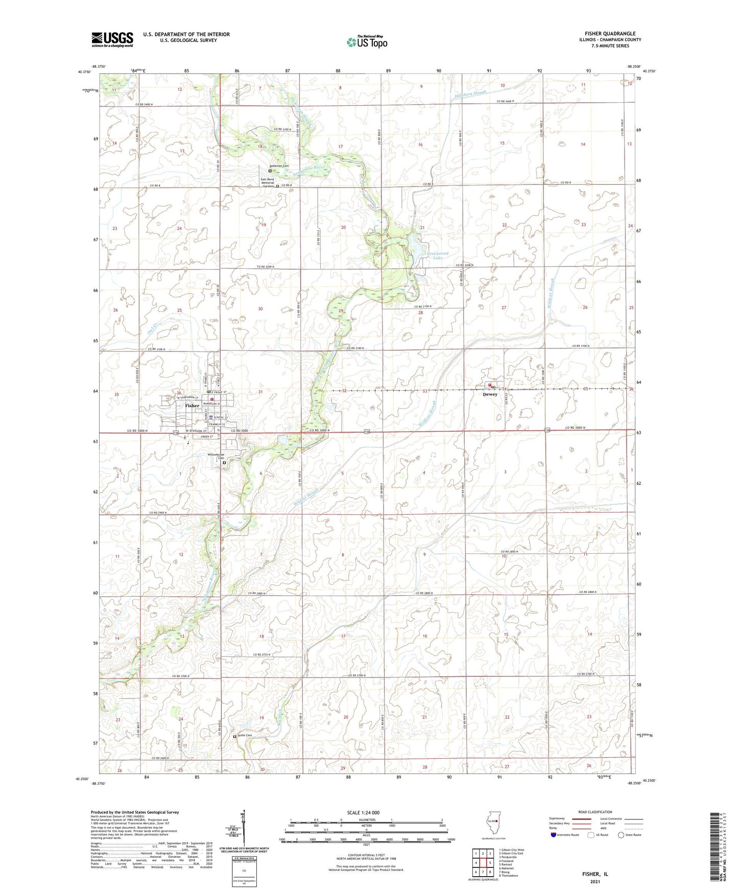
2024 topographic map quadrangle Fisher in the state of Illinois. Scale: 1:24000. Based on the newly updated USGS 7.5' US Topo map series, this map is in the following counties: Champaign. The map contains contour data, water features, and other items you are used to seeing on USGS maps, but also has updated roads and other features. This is the next generation of topographic maps. Printed on high-quality waterproof paper with UV fade-resistant inks.
Quads adjacent to this one:
West: Foosland
Northwest: Gibson City West
North: Gibson City East
Northeast: Perdueville
East: Rantoul
Southeast: Thomasboro
South: Rising
Southwest: Mahomet
This map covers the same area as the classic USGS quad with code o40088c3.
Contains the following named places: Beekman Cemetery, Big Ditch, Dewey, Dewey Census Designated Place, Dewey Mennonite Church, Dewey Post Office, Dickerson Slough, Drummer Creek, East Bend Memorial Gardens, East Bend Mennonite Church, Fisher, Fisher Church of Christ, Fisher Grade School, Fisher High School, Fisher Police Department, Fisher Post Office, Fisher United Methodist Church, Furtney Airport, Greenwood Lake, Greenwood Lake Dam, Hillsbury Slough, Houstonville Post Office, Knife Cemetery, Mounts School, Owl Creek, Sangamon Valley Fire Protection District Station 1, Sangamon Valley Fire Protection District Station 2, Township of Condit, Township of East Bend, Village of Fisher, Wildcat Slough, Willowbrook Cemetery, ZIP Codes: 61840, 61843