MyTopo
Rising Illinois US Topo Map
Couldn't load pickup availability
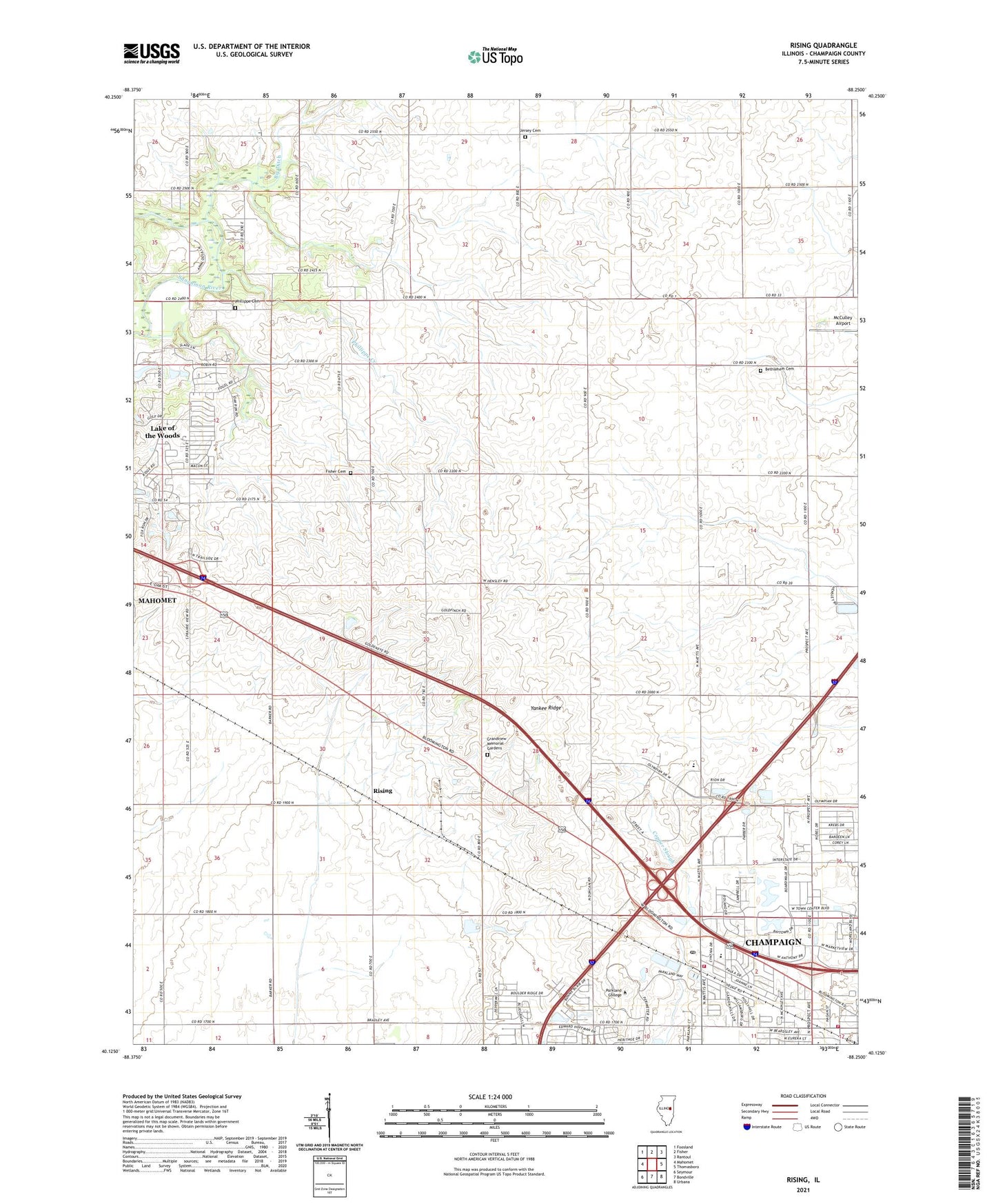
2024 topographic map quadrangle Rising in the state of Illinois. Scale: 1:24000. Based on the newly updated USGS 7.5' US Topo map series, this map is in the following counties: Champaign. The map contains contour data, water features, and other items you are used to seeing on USGS maps, but also has updated roads and other features. This is the next generation of topographic maps. Printed on high-quality waterproof paper with UV fade-resistant inks.
Quads adjacent to this one:
West: Mahomet
Northwest: Foosland
North: Fisher
Northeast: Rantoul
East: Thomasboro
Southeast: Urbana
South: Bondville
Southwest: Seymour
This map covers the same area as the classic USGS quad with code o40088b3.
Contains the following named places: Andrew RLA Airport, Bethlehem Cemetery, Bethlehem Church, Bunker Hill School, Champaign Airport, Champaign Fire Department Station 3, Champaign Fire Department Station 5, Champaign Post Office, Dodds Park, Fisher Cemetery, Garden Hills Elementary School, Garden Hills Park, Grandview Memorial Gardens, Hensley School, Interstate Research Park, Jersey Cemetery, Lake of the Woods, Lake of the Woods Census Designated Place, McCulley Airport, Mount Vernon Church, Oak Grove Church, Parkland College, Phillippe Cemetery, Phillippe Creek, Rising, Thompson Park, Township of Hensley, WBCP-AM (Urbana), WEFT-FM (Champaign), WHZT-FM (Mahomet), WLRW-FM (Champaign), WPCD-FM (Champaign), Yankee Ridge, ZIP Code: 61822