MyTopo
Smithfield Illinois US Topo Map
Couldn't load pickup availability
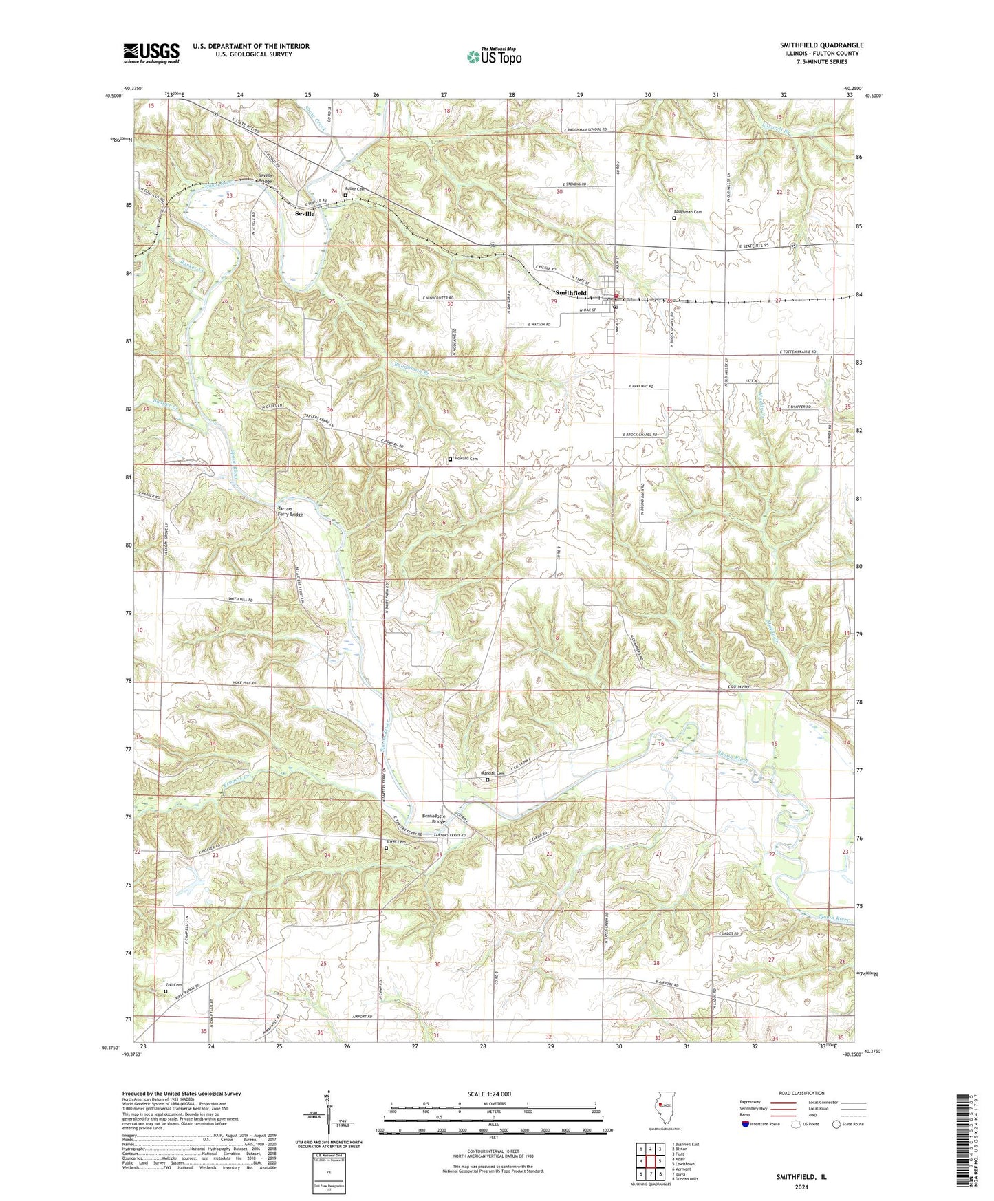
2024 topographic map quadrangle Smithfield in the state of Illinois. Scale: 1:24000. Based on the newly updated USGS 7.5' US Topo map series, this map is in the following counties: Fulton. The map contains contour data, water features, and other items you are used to seeing on USGS maps, but also has updated roads and other features. This is the next generation of topographic maps. Printed on high-quality waterproof paper with UV fade-resistant inks.
Quads adjacent to this one:
West: Adair
Northwest: Bushnell East
North: Blyton
Northeast: Fiatt
East: Lewistown
Southeast: Duncan Mills
South: Ipava
Southwest: Vermont
This map covers the same area as the classic USGS quad with code o40090d3.
Contains the following named places: Badger Creek, Barker Creek, Baughman Branch, Baughman Cemetery, Bernadotte, Bernadotte Bridge, Brock School, Elrod Bridge, Elrod School, Francis Creek, Fuller Cemetery, Harper - Rector Woods Nature Preserve, Hawthorne School, Hickory Grove School, Howard Cemetery, Howard Church, Howerter School, Hull School, Humphreys Branch, Jones School, Little Brick School, Medley School, Muddy Creek, Poverty Ridge, Randall Cemetery, Reese School, Seville, Seville Bridge, Seville School, Shaw Creek, Smithfield, Smithfield Fire Protection District, Smithfield Post Office, Smithfield School, Stites Cemetery, Tartars Ferry Bridge, Township of Bernadotte, Township of Cass, Turner Farms, Village of Smithfield, Zoll Cemetery, ZIP Code: 61477