MyTopo
Victoria Illinois US Topo Map
Couldn't load pickup availability
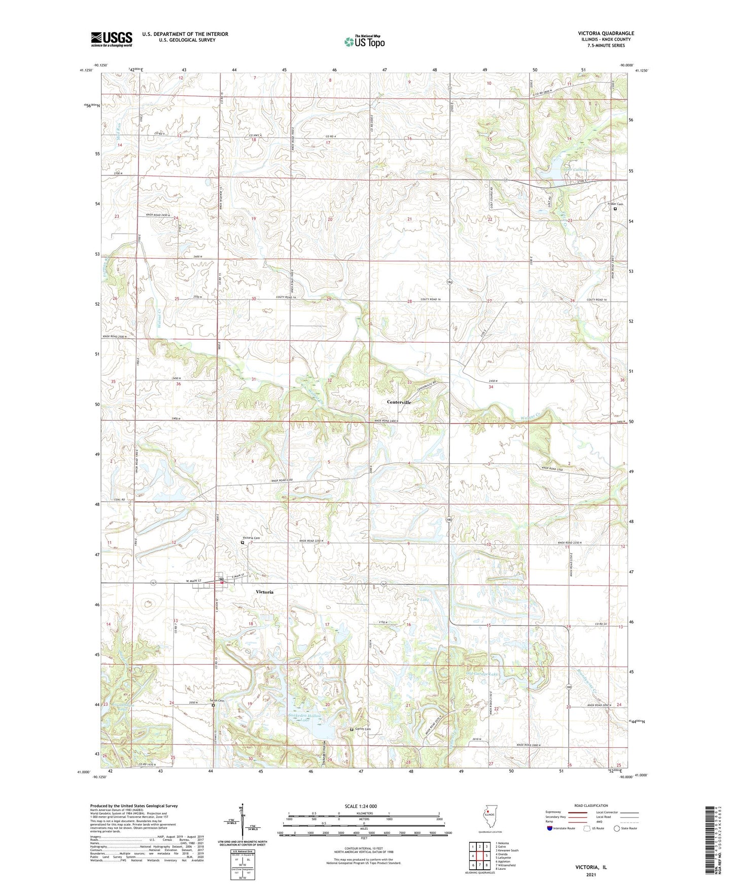
2024 topographic map quadrangle Victoria in the state of Illinois. Scale: 1:24000. Based on the newly updated USGS 7.5' US Topo map series, this map is in the following counties: Knox. The map contains contour data, water features, and other items you are used to seeing on USGS maps, but also has updated roads and other features. This is the next generation of topographic maps. Printed on high-quality waterproof paper with UV fade-resistant inks.
Quads adjacent to this one:
West: Oneida
Northwest: Nekoma
North: Galva
Northeast: Kewanee South
East: Lafayette
Southeast: Laura
South: Williamsfield
Southwest: Appleton
This map covers the same area as the classic USGS quad with code o41090a1.
Contains the following named places: Ale School, Browne School, Calhoun Lake Dam, Centerville, Chalman School, Collinson School, Fairview School, Forman Creek, Fraker Cemetery, Garret Cemetery, Gibbs School, Lake Calhoun, Number 16 School, Old Garage Lake, Smith Cemetery, Snakeden Hollow Lake, Snakeden Hollow State Fish and Wildlife Area, Sole School, T Lake, Township of Lynn, Township of Victoria, Union School, Victoria, Victoria - Copley Fire Protection District, Victoria Cemetery, Victoria Elementary School, Victoria Post Office, Village of Victoria, ZIP Code: 61485