MyTopo
Williamsfield Illinois US Topo Map
Couldn't load pickup availability
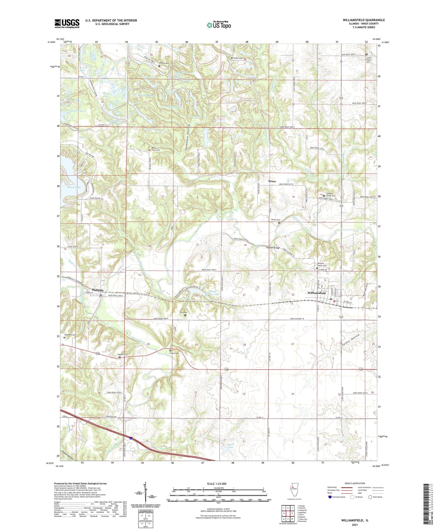
2024 topographic map quadrangle Williamsfield in the state of Illinois. Scale: 1:24000. Based on the newly updated USGS 7.5' US Topo map series, this map is in the following counties: Knox. The map contains contour data, water features, and other items you are used to seeing on USGS maps, but also has updated roads and other features. This is the next generation of topographic maps. Printed on high-quality waterproof paper with UV fade-resistant inks.
Quads adjacent to this one:
West: Appleton
Northwest: Oneida
North: Victoria
Northeast: Lafayette
East: Laura
Southeast: Elmwood
South: Yates City
Southwest: Maquon
This map covers the same area as the classic USGS quad with code o40090h1.
Contains the following named places: Baird School, Bradford Cemetery, Brandywine Creek, Cadwell Creek, Caldwell Family Cemetery, Camp Feltheimer, Centennial School, Center Prairie Cemetery, Center Prairie Church, Center Prairie School, Chain of Lakes, Corbin Cemetery, Corn Crib Lake, Court Creek, Crawdad Lake, Dahinda, Dahinda Post Office, Daum Lake, Daum Lake Dam, Etherly Cemetery, Etherly School, Eugene, Eugene School, Fink Cemetery, Green Oaks Lake, Happy Hollow Lake, Happy Hollow Lake Dam, Happy Hollow Lake Number 2 Dam, Lapham Bridge, Lapham School, Little John Club Lake, Lone Rock Lake, Long Lake, Lost Lake, Parker Cemetery, Round Bottom School, Salem Cemetery, Salem School, Snakeden Hollow, South Lake, Spoon Lake, Spoon Lake Dam, Stump Valley School, Sugar Creek, Township of Truro, Trailer Lake, Trenton Bridge, Trenton Cemetery, Trenton Corners, Trenton School, Truro, Tucker Hollow, U Lake, Village of Williamsfield, West Elba School, West Truro Cemetery, West Truro School, Williams Family Cemetery, Williamsfield, Williamsfield Fire Protection District - Station 1, Williamsfield High School, Williamsfield Post Office, ZIP Codes: 61428, 61489