MyTopo
Laura Illinois US Topo Map
Couldn't load pickup availability
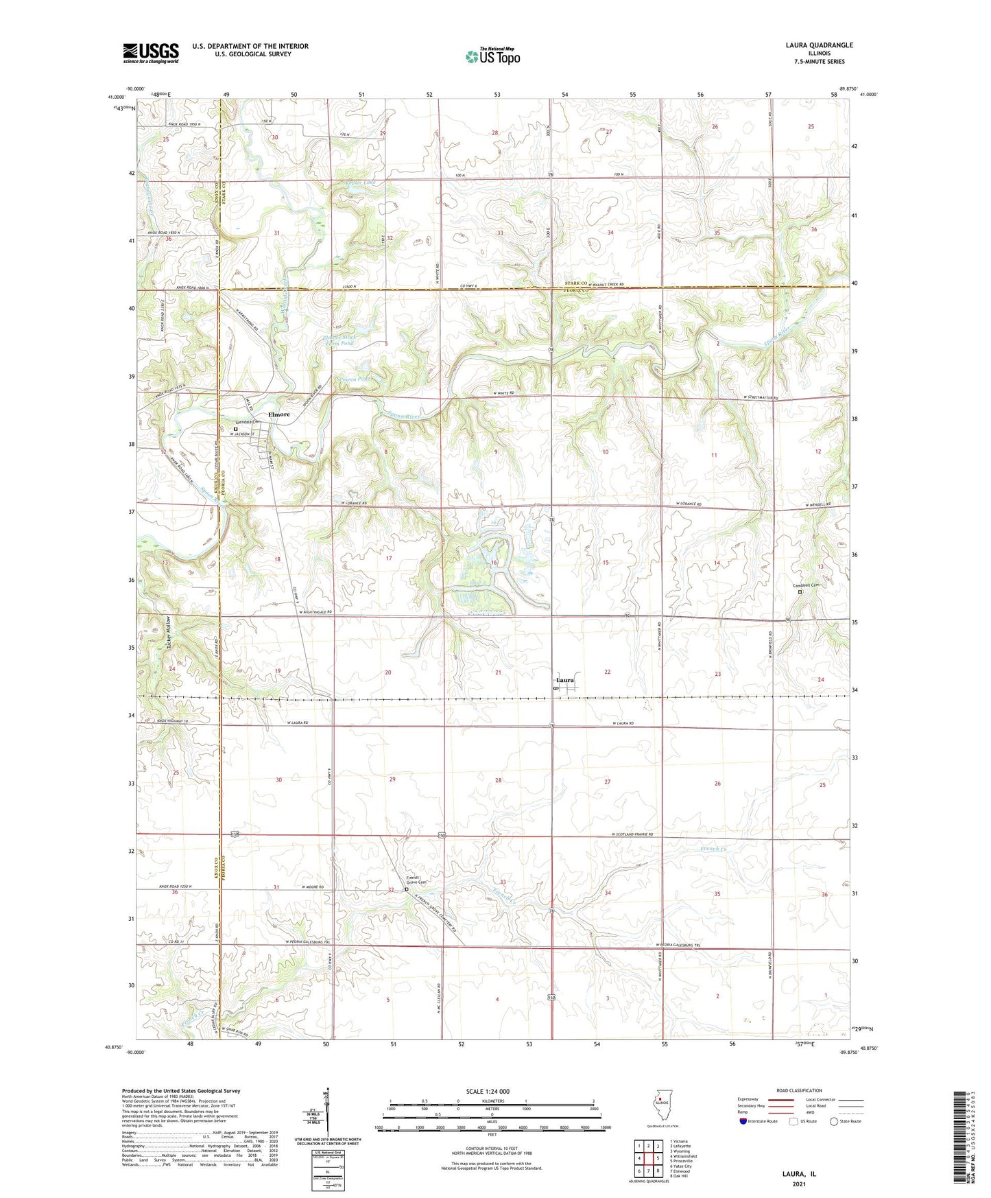
2024 topographic map quadrangle Laura in the state of Illinois. Scale: 1:24000. Based on the newly updated USGS 7.5' US Topo map series, this map is in the following counties: Peoria, Stark, Knox. The map contains contour data, water features, and other items you are used to seeing on USGS maps, but also has updated roads and other features. This is the next generation of topographic maps. Printed on high-quality waterproof paper with UV fade-resistant inks.
Quads adjacent to this one:
West: Williamsfield
Northwest: Victoria
North: Lafayette
Northeast: Wyoming
East: Princeville
Southeast: Oak Hill
South: Elmwood
Southwest: Yates City
This map covers the same area as the classic USGS quad with code o40089h8.
Contains the following named places: Campbell Cemetery, Cowen Pond, Cowen Pond Dam, Dixie School, Elmore, Elmore Stock Farm Pond, Elmore Stock Farm Pond Dam, French Grove Cemetery, Glendale Cemetery, Kepler Lake, Kepler Lake Dam, Laura, Laura Post Office, Nightingale School, Pleasant Hill School, Scotland School, Township of Millbrook, Walnut Creek, ZIP Code: 61451