MyTopo
Lafayette Illinois US Topo Map
Couldn't load pickup availability
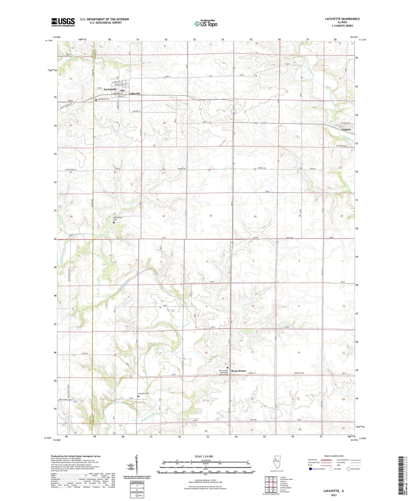
2024 topographic map quadrangle Lafayette in the state of Illinois. Scale: 1:24000. Based on the newly updated USGS 7.5' US Topo map series, this map is in the following counties: Stark, Knox. The map contains contour data, water features, and other items you are used to seeing on USGS maps, but also has updated roads and other features. This is the next generation of topographic maps. Printed on high-quality waterproof paper with UV fade-resistant inks.
Quads adjacent to this one:
West: Victoria
Northwest: Galva
North: Kewanee South
Northeast: Elmira
East: Wyoming
Southeast: Princeville
South: Laura
Southwest: Williamsfield
This map covers the same area as the classic USGS quad with code o41089a8.
Contains the following named places: Bumble Bee School, Fitch Creek, Goshen School, Hamilton School, Hickory Grove School, Lafayette, LaFayette Cemetery, Lafayette Fire Department, Lawndale School, Mason Creek, McClenahan Cemetery, Morgan - Richey Jersey Farm, Nicholson School, Pleasant View School, Quinn School, Shockley Cemetery, Township of Goshen, Township of West Jersey, Village of La Fayette, Vinegar Hill School, West Jersey, West Jersey Methodist Churchyard, Winans School, ZIP Codes: 61449, 61483