MyTopo
Belgique Missouri US Topo Map
Couldn't load pickup availability
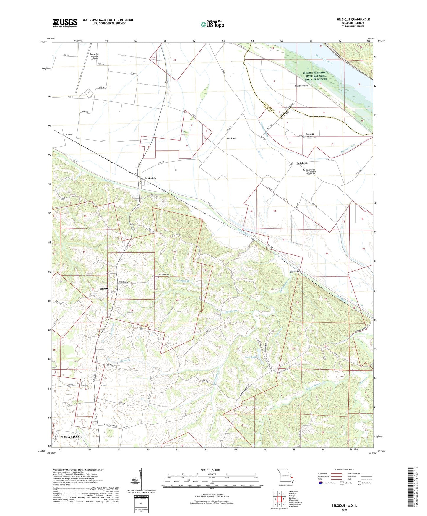
2021 topographic map quadrangle Belgique in the states of Missouri, Illinois. Scale: 1:24000. Based on the newly updated USGS 7.5' US Topo map series, this map is in the following counties: Perry, Randolph. The map contains contour data, water features, and other items you are used to seeing on USGS maps, but also has updated roads and other features. This is the next generation of topographic maps. Printed on high-quality waterproof paper with UV fade-resistant inks.
Quads adjacent to this one:
West: Lithium
Northwest: Kaskaskia
North: Chester
Northeast: Welge
East: Rockwood
Southeast: Crosstown
South: Perryville East
Southwest: Perryville West
This map covers the same area as the classic USGS quad with code o37089g7.
Contains the following named places: Belgique, Big Hollow, Boxdorfer School, Brown Branch, Christisen Branch, Crains Island, Dry Fork, Hoff School, Huber Branch, Lady of Victory Church, McBride, McClanahan Creek, McClannahan Mill, Miles School, Morey School, Nativity Of The Blessed Virgin Cemetery, Perryville Regional Airport, Preston Cemetery, Puckett Island, School Number 73, Sereno, Sereno School, Streiler Branch, Township of Bois Brule, Turkey Toe Canyon Lake Dam, Twin Lakes, Twin Lakes Lower Dam