MyTopo
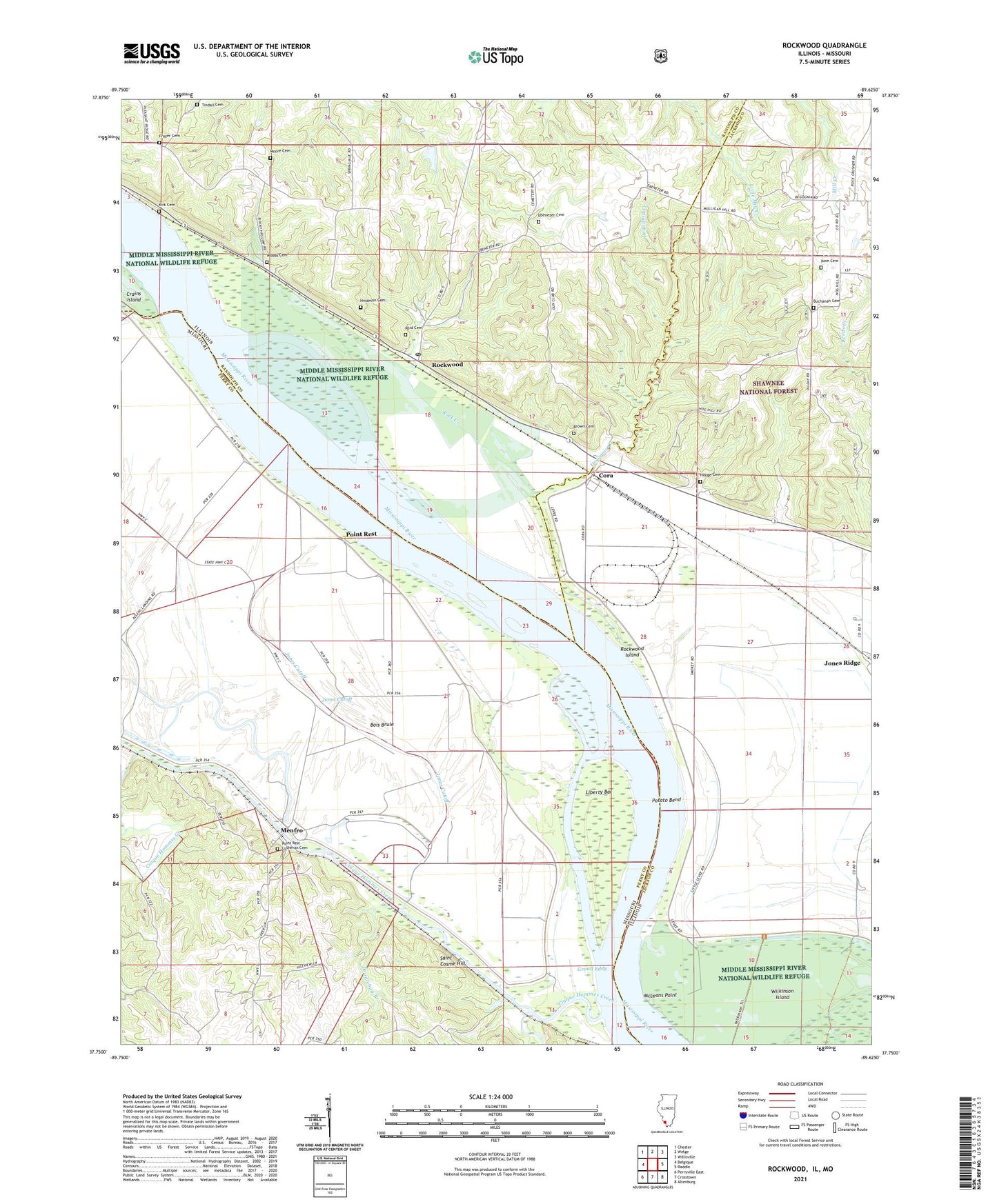
Rockwood Illinois US Topo Map
Couldn't load pickup availability
Also explore the Rockwood Forest Service Topo of this same quad for updated USFS data
2024 topographic map quadrangle Rockwood in the states of Illinois, Missouri. Scale: 1:24000. Based on the newly updated USGS 7.5' US Topo map series, this map is in the following counties: Jackson, Perry, Randolph. The map contains contour data, water features, and other items you are used to seeing on USGS maps, but also has updated roads and other features. This is the next generation of topographic maps. Printed on high-quality waterproof paper with UV fade-resistant inks.
Quads adjacent to this one:
West: Belgique
Northwest: Chester
North: Welge
Northeast: Willisville
East: Raddle
Southeast: Altenburg
South: Crosstown
Southwest: Perryville East
Contains the following named places: Allen Lane School, Allens Landing, Antioch School, Bishop Landing, Bois Brule Creek, Brown Cemetery, Buchanan Cemetery, Buchanan School, Cinque Hommes Creek, Clifton School, Cora, Crosstown School, Degognia, Degognia Creek, Doodlebug Branch, Ebenezer Cemetery, Ebenezer Church, Ebenezer School, Frazer Cemetery, Grand Eddy, Hindman Cemetery, Houge Cemetery, Island School, Isom Cemetery, Jones Cutoff, Jones Point, Jones Pond, Jones Ridge, Kirk Cemetery, Liberty Bar, Mansker Post Light, McLeans Point, Menfro, Middle Mississippi River National Wildlife Refuge, Missouri Chute, Moore Cemetery, Omete Creek, Pleasant Grove School, Pleasant Ridge Church, Point Rest, Potato Bend, Reid Cemetery, Rock Creek, Rockwood, Rockwood Election Precinct, Rockwood Island, Rockwood Post Office, Saint Cosme Hill, Tindall Cemetery, Township of Degognia, Village of Rockwood, Wagners Landing, Waters Point Post Light, Woods Cemetery, ZIP Code: 62280